
Business Details
31 Years
experience
Expert Land Surveying Services in California
We are GUIDA, a family-oriented business with 28 years of expertise in land surveying since 1995. Our approach combines traditional methodologies with innovative technologies like LiDAR, UAV, and GPS to deliver accurate and efficient solutions for municipal and private projects across California. As an SBE and WBE-certified firm, we prioritize fostering long-term client relationships while maintaining strict adherence to quality and accuracy.Our team of licensed professionals brings decades of combined experience in solving complex survey challenges, ensuring reliable service for projects of all sizes. We are committed to industry leadership through continuous adaptation to technological advancements while upholding core values of integrity and client satisfaction.

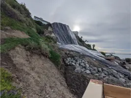

Services
Land Surveys
Geodetic Control
UAV Services
Right of Way Engineering
GIS Solutions
Details
- Year established: 1995
Highlights and features
- We offer 28 years of specialized experience in California land surveying.
- Our team utilizes innovative technologies like LiDAR and UAV for precision.
- Certified as Small Business Enterprise and Women-Owned Business Enterprise.
- We serve clients across all major California regions with local expertise.
- Our 98% client retention rate demonstrates consistent quality and reliability.
Associations and certifications
- Department of General Services
- California Public Utilities Commission
What people say
Exemplary customer service
Top notch survey company
Paper work spot on
Great to work with
Accurate measurements
Services
Land Surveys
GUIDA provides comprehensive land surveying services using traditional methods and modern technology to establish boundaries and map terrain. Our licensed professionals execute cadastral surveys, boundary analysis, and topographic mapping for property development and infrastructure projects. Utilizing GPS and robotic equipment, we ensure precise measurements to support construction, legal documentation, and land management needs across California.
UAV Services
Our FAA-certified UAV operations capture high-resolution imagery and geospatial data for efficient site analysis. Specializing in photogrammetry, we generate 3D models and orthophotos to support construction monitoring, volumetric calculations, and topographic surveys. This technology reduces field time by 40% while maintaining 2cm accuracy, providing cost-effective solutions for large-scale and complex projects requiring rapid data acquisition.
Right of Way Engineering
GUIDA delivers complete right-of-way engineering solutions including title research, boundary analysis, and acquisition mapping. We prepare legal descriptions, appraisal maps, and condemnation packages for public infrastructure projects. Our team's expertise in cadastral history ensures accurate land net surveys, facilitating property acquisition processes for transportation and utility clients across California's diverse regulatory environments.
GIS Solutions
We integrate advanced GIS technology with survey data to create comprehensive spatial databases for land and infrastructure management. Our specialists develop custom GIS platforms for storm drain systems, utility networks, and land parcel data, enhancing decision-making for public agencies and private developers. By merging traditional surveying with digital mapping, we deliver actionable insights for long-term asset management and project planning.
Geodetic Control Surveys
Our geodetic control surveys establish precise horizontal and vertical reference frameworks for large-scale projects. Using GNSS technology and NGS CORS networks, we create accurate datums that ensure consistency across multiple survey phases. These control networks support transportation infrastructure, utility corridors, and development projects requiring millimeter-level precision over expansive areas.
People
Meagan Guida
CEO
With over 25 years leading GUIDA's strategic growth, Meagan GUIDA oversees operations and client relations. Her leadership has expanded our California presence while maintaining family-oriented business values. She champions innovation in survey technology and promotes industry diversity through our WBE certification.
Questions
What surveying services does GUIDA offer?
We provide land surveying, geodetic control, UAV mapping, right-of-way engineering, utility locating, construction staking, LiDAR scanning, and GIS solutions for public and private projects.
How long has GUIDA been in business?
GUIDA has specialized in California land surveying since 1995, maintaining continuous operations with steady growth over 28 years.
Are you certified as a minority-owned business?
Yes, we hold SBE certification from multiple agencies and WBE certification from the California Public Utilities Commission.
Which areas do you serve in California?
We operate statewide with offices in Irvine (HQ), Pleasanton, Fresno, Ontario, and Escondido covering all major regions.
What technology does GUIDA use for surveying?
We combine traditional total stations with modern tools like UAV drones, LiDAR scanners, GPS RTK systems, and photogrammetry software.
How can I request a survey quote?
Contact our Irvine headquarters at (949) 777-2000 or complete our online form for prompt consultation and project estimation.
Reviews (1)
Jeremy Koehler
Jun 25, 2019
Report
Guida Surveying is a great company to work with, especially Tim Fettig in their Orange County office. We have used their services for over 10 years and I could not recommend them more!