Business Details
34 Years
experience
Civil Engineering & Surveying Experts in Scarborough, ME
Established in 1992, Northeast Civil Solutions has grown into one of northern New England's leading surveying and engineering firms. Our team delivers comprehensive land surveying, civil engineering, and environmental services, including boundary surveys, stormwater management, and federal permitting. With offices in Scarborough, Maine, we serve government agencies, municipalities, and private clients across New England. Our senior management ensures each project receives tailored expertise from professionals licensed in civil engineering and land surveying. Our staff's multidisciplinary skills and rigorous quality control processes guarantee solutions that meet the highest industry standards. We specialize in complex projects requiring precision, from coastal infrastructure to utility engineering and wetlands mitigation.Our commitment to technical excellence and client collaboration has earned us recognition as a trusted partner for challenging developments. With decades of combined experience, our team combines deep regional knowledge with advanced technical capabilities to deliver reliable, code-compliant results. We maintain active licenses in multiple states and hold specialized certifications, including wetlands delineation, to address diverse project requirements. Our focus remains on providing accurate data, innovative designs, and regulatory expertise to help clients achieve their objectives efficiently and sustainably.

Services
Land Surveying
Civil Engineering
Wetlands Delineation
Permitting Services
Topographic Surveys
Boundary Surveys
Stormwater Management
Utility Engineering
Shoreline Stabilization
Hydrographic Surveys
Details
- Year established: 1992
Highlights and features
- We have over 40 years of combined leadership experience in surveying and engineering.
- Our multidisciplinary team includes licensed professionals in multiple states.
- We maintain rigorous quality control processes for all project deliverables.
- Our staff holds specialized certifications including wetlands delineation.
- We provide tailored solutions for complex infrastructure and environmental projects.
Associations and certifications
- Professional Engineers licensed in Maine
- Professional Land Surveyors licensed in Maine
- Wetlands Delineation Certified by the state of New Hampshire
Services
Land Surveying
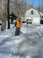
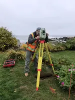
Our land surveying services provide precise boundary determinations and topographic data using advanced GPS and field equipment. We conduct ALTA/NSPS standards surveys, FEMA elevation certificates, and subsurface utility mapping. Clients receive detailed plans exceeding industry accuracy requirements for residential, commercial, and infrastructure projects.
Civil Engineering
We deliver comprehensive civil engineering solutions including stormwater management systems, roadway designs, and utility engineering. Our team creates erosion control plans and hydrological models that comply with federal and state regulations. Projects benefit from our expertise in municipal permitting and construction administration for public and private developments.
Wetlands Delineation
Our certified specialists identify and map jurisdictional wetlands following state protocols. We prepare mitigation plans and secure required permits from agencies like the Army Corps of Engineers. This service supports developers in meeting environmental compliance while maintaining project timelines and budget constraints.
Permitting Services
We navigate complex federal, state, and local permitting processes for infrastructure and development projects. Our team prepares technical submittals, coordinates agency meetings, and ensures compliance with environmental regulations. Clients receive strategic guidance to expedite approvals while addressing all regulatory requirements.
Hydrographic Surveys
We perform detailed hydrographic surveys for coastal and inland water projects using specialized sonar equipment. These surveys support pier construction, shoreline stabilization, and navigational safety assessments. Data collection includes submerged topography and underwater structure inspections to inform engineering designs.
People
Troy McDonald
President, PLS
With over 40 years of experience, Troy leads surveying operations and business development. He holds land surveyor licenses in Maine and previously directed marketing for telephony engineering firms. His expertise spans civil design and project management.
Alex Frederick
Director of Survey
Alex manages land surveying operations with 10 years of field experience. He specializes in boundary resolution and deed research while pursuing his Professional Land Surveyor license. His technical skills support complex cadastral projects across northern New England.
Jim Fisher
Senior Associate
Jim focuses on permitting processes and municipal presentations. With a master's degree and Oxford research experience, he directs business development and client relations. His Army Corps-certified wetlands expertise informs environmental compliance strategies.
Connor Bourassa
Permitting Specialist/Project Engineer
Connor coordinates regulatory approvals and engineering designs. He applies technical knowledge to streamline permitting workflows while ensuring compliance with environmental statutes for infrastructure and development projects.
Jeremy Vieu
Project Surveyor
Jeremy executes field surveys and data analysis for boundary and topographic projects. His technical proficiency supports accurate deliverables meeting ALTA/NSPS standards for commercial and municipal clients across New England.
Questions
What geographic areas do you serve?
We operate throughout New England, with primary focus areas in Maine, Massachusetts, and New Hampshire for surveying, engineering, and permitting projects.
What surveying certifications do your staff hold?
Our team includes Professional Land Surveyors licensed in Maine and specialists certified in wetlands delineation by the state of New Hampshire.
How do you handle complex infrastructure projects?
We assign multidisciplinary teams with expertise in surveying, civil engineering, and environmental compliance to ensure comprehensive solutions for transportation, utility, and coastal infrastructure projects.
Can you assist with federal permitting requirements?
Yes, we secure permits from agencies including the Army Corps of Engineers and prepare technical documentation for federal, state, and local regulatory compliance.
What technologies do you use for surveying?
We employ GPS systems, total stations, and hydrographic sonar equipment to deliver precise data meeting ALTA/NSPS standards for boundary, topographic, and underwater surveys.
How do you ensure project quality control?
Our process includes field verification, office plan reviews, and multi-stage checks by licensed professionals to guarantee accuracy exceeding industry standards for all deliverables.