
Business Details
Expert Land Surveying Services in Portland, ME
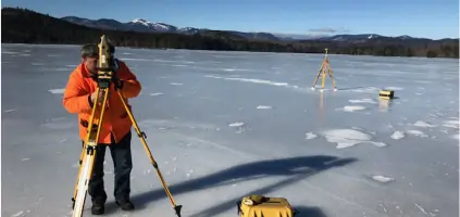
At Nadeau Land Surveys, we combine cutting-edge technology with a steadfast commitment to traditional work ethic to deliver precise land surveying solutions. Our team of three licensed Maine Professional Land Surveyors brings decades of collective experience to boundary surveys, floodplain assessments, and utility locating projects. We prioritize client education, offering detailed reviews of our findings to ensure transparency and understanding.With a focus on accuracy and reliability, we serve residential, commercial, and government clients across Maine, supporting critical processes like property transactions, flood insurance evaluations, and construction projects. Our dedication to quality is reflected in our meticulous approach to data collection, historical research, and regulatory compliance, making us a trusted partner for all land surveying needs.

Services
Boundary Surveys
Elevation Certificates
Mortgage Loan Inspections
Underground Utility Locating
Floodplain Services
Topographic Surveys
ALTA Surveys
Construction Layout
Wetland Mapping
Bathymetric Surveys
Highlights and features
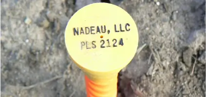
- We hold three licensed Maine Professional Land Surveyor certifications (#2124, #2370, #2446)
- Our team provides client education through post-project findings reviews
- We offer specialized floodplain risk assessment and FEMA compliance services
- We utilize GPS mapping and ground-penetrating radar for precision surveys
- Our staff includes dedicated Education Coordinators for technical training
What people say
Accommodated to my schedule
Trusted your plan
Beneficial findings review
Precise elevation data
Knowledgeable team
Services
Boundary Surveys
Our boundary surveys precisely define property lines using historical records and modern GPS technology. We resolve disputes through accurate measurements and documentation. Clients receive detailed maps and explanations of corner markers.
Elevation Certificates
We create FEMA-compliant elevation certificates to determine flood risk and insurance requirements. Our surveys document building elevations relative to flood zones using certified measurement techniques. Results help clients potentially reduce insurance costs.
Underground Utility Locating
Using ground-penetrating radar and GPS, we locate subsurface utilities under our AAB Utility Locating division. Our surveys identify water, sewer, and electrical lines to prevent damage during construction projects.
Mortgage Loan Inspections
We perform mortgage loan inspections to verify property compliance with lending requirements. Our services include flood zone determination, setback verification, and providing documentation directly to loan processors for closing.
Topographic Surveys
Our topographic surveys map natural and man-made features with elevation data. This information supports construction planning, drainage analysis, and land development projects across residential and commercial properties.
People
Jim Nadeau
Owner
Licensed Maine Professional Land Surveyor #2124 with over 30 years of experience. Leads team operations and client relations while maintaining active field involvement in complex survey projects.
Jim Reidy
Professional Land Surveyor
Licensed Maine Professional Land Surveyor #2370 specializing in boundary resolution and elevation certificate projects. Brings technical expertise to coastal property assessments and floodplain mapping.
Alex
Surveyor
Licensed Maine Professional Land Surveyor #2446 with expertise in construction layout and bathymetric surveys. Participates in both field data collection and office plan preparation.
Questions
What land surveying services do you offer?
We provide boundary surveys, elevation certificates, mortgage loan inspections, utility locating, floodplain assessments, topographic surveys, ALTA/ACSM surveys, and construction layout services.
How can an elevation certificate help lower flood insurance costs?
Our elevation certificates document building elevations relative to flood zones, which may qualify homeowners for reduced insurance premiums through FEMA's NFIP.
Do you handle commercial property surveys?
Yes, we serve commercial clients with boundary evaluations, site plans, construction layout, and utility mapping for developments and municipal permits.
What technology do you use for surveys?
We employ GPS mapping, ground-penetrating radar, and bathymetric survey equipment to ensure precise data collection for all project types.
Can you assist with mortgage loan requirements?
Yes, we provide Mortgage Loan Inspections including setback compliance, flood zone determination, and direct delivery of MLI plans to loan processors.
Do you work on government infrastructure projects?
Yes, we've completed surveys for schools, water districts, veterans' memorials, and FEMA flood hazard mapping across Maine.
Videos
Reviews (2)
Peter C.
Jun 26, 2024
Report
I reached out to five highly reputable surveying professionals for proposals, and Nadeau stood out from the start. They had the quickest response time, the most efficient turnaround, excellent communication, and the best price. Most importantly, the results were fantastic. Professional boundary surveys are more expensive than many people realize, but in my case, the investment was absolutely worth it. I learned more about my property than I ever could have imagined, and I couldnt be happier with the service I received.
Darren Sheridan
Apr 19, 2022
Report
Asked Jim for a quote to help identify existing property pins or find where they should be for the purposes of installing a fence on the property line. I have a 12,000 square foot lot. I was given a quote for over $4k. I asked for some explanation as I've had other surveys done on much larger and more complex properties for only a few hundred dollars. Unfortunately I did not get any reasonable effort to help me understand why the quote was so much or any willingness to reduce price. Seems like an insane price for what I'm looking for as a homeowner looking to install a fence. Would not recommend.