Business Details
42 Years
experience
Professional Land Surveying Services in Asheville, NC
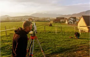
Since 1984, Blue Ridge Land Surveying has been dedicated to delivering high-quality land surveying services across Western North Carolina. Our approach combines cutting-edge technology, including electronic total station instruments and digital mapping tools, with a commitment to old-fashioned integrity. Our team of licensed professionals brings decades of combined experience in boundary disputes, construction layout, and geographic information systems.We prioritize client needs while maintaining rigorous standards of accuracy and public welfare. Our founders and staff have held leadership roles in professional societies and contributed to industry education through teaching and publications. We serve diverse sectors, including civil engineering, legal cases, and infrastructure development, ensuring precise and reliable surveying solutions tailored to each project's unique requirements.

Services
Land Surveying
Boundary Surveys
Construction Layout
GIS Mapping
Expert Testimony
Details
- Year established: 1984
Highlights and features
- We offer 40+ years of combined experience in North Carolina land surveying
- Our team includes licensed professionals with expertise in boundary disputes
- We utilize advanced technology for accurate digital mapping and data collection
- Our staff has held leadership roles in state and national surveying societies
- We provide expert witness services for legal boundary dispute cases
Services
Land Surveying
Professional land surveying services using advanced technology for accurate property boundary determination. Our team conducts comprehensive deed research and field measurements to resolve disputes and establish legal boundaries. Services include topographic mapping and ALTA/NSPS surveys for residential, commercial, and governmental clients.
Construction Layout
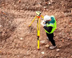
Precision construction layout services for buildings, roads, and infrastructure projects. We use total station instruments to mark exact locations for foundations, utilities, and structural elements. Our work ensures compliance with engineering plans and building codes across Western North Carolina.
GIS Mapping
Geographic Information System mapping services that convert field data into digital formats for analysis and planning. We create detailed topographic maps and spatial data layers to support land development, environmental assessments, and municipal projects in Asheville and surrounding areas.
Expert Testimony
Expert witness services for boundary dispute litigation and land-related legal cases. Our licensed surveyors provide court testimony based on thorough field investigations and historical document analysis. We've supported both civil and criminal cases with technical expertise since 1984.
Boundary Surveys
Comprehensive boundary surveys that identify property lines, easements, and encroachments. Our process combines modern technology with traditional research methods to produce legally defensible surveys. Services include preparation of survey plats and documentation for real estate transactions.
People
Darius Nazari
Licensed Professional Land Surveyor
Licensed since 2017, Darius has over 25 years of field experience. He specializes in boundary determination and construction layout, returning to Blue Ridge in 2000 after Florida surveying experience. He commutes from Yancey County to serve Asheville clients.
Graham N. Duls
Professional Land Surveyor
Licensed in 2009, Graham has specialized in land surveying since 1998. He develops GIS workflow solutions and belongs to national and state surveying societies. He joined Blue Ridge in 2015 to enhance technical capabilities.
Dennis Campbell III
Professional Land Surveyor
Licensed since 1986, Dennis authored surveying software and boundary dispute expert witness materials. He served as Western Chapter President of NC Surveyors and taught at Asheville-Buncombe Technical College.
Ken Mills
Professional Land Surveyor
Licensed since 1976, Ken has written extensively on surveying topics and taught seminars on field evidence and legal testimony. He served as President of both state and local surveying societies.
Questions
What services does Blue Ridge Land Surveying offer?
We provide boundary surveys, construction layout, GIS mapping, expert witness testimony, and land surveying for residential, commercial, and legal projects across Western North Carolina.
Are your surveyors licensed professionals?
Yes, all our lead surveyors hold active North Carolina Professional Land Surveyor licenses with decades of combined field experience.
How do you handle complex boundary disputes?
Our team combines historical deed research with modern technology to resolve disputes, including expert court testimony when required.
What technology do you use for surveys?
We utilize electronic total stations, digital data collectors, and GIS tools for precise measurements and digital mapping solutions.
Can you assist with construction projects?
Yes, we provide construction layout services for buildings, roads, and infrastructure projects with high-accuracy field measurements.
Reviews (6)
Rmd Rmd
May 19, 2022
Report
Darius was great, extremely professional. Fair quote. Scheduled well in advance. Needed to be on time for property under contract and it was. Pleasure to work with.
Mark Gaudet
Nov 27, 2021
Report
Exceptionally professional and competent team. Easy to work with. These guys have been around for 30+ years and have a well-deserved great reputation. We had zero problems with a complicated redraw request to Buncombe county. BRLS met every timeline they set, I got an excellent product, and even better service. Graham, Ken, and Coner we're all pros. Highly recommended. needed a redraw of contiguous lots
Sergio Manzo
Sep 30, 2020
Report
Thank you Dennis, I had problems with neighbors taking out pins so I had to call someone to re-pin them. Dennies and his crew came on time. He explained to me what he was going to do and asked if I had any concerns. Very professional. He came back the following day to show me the property lines. He even gave me edited paper copies of the property line with my new fence included. Very fast. I would use their services again.
Lee Tufte
May 04, 2019
Report
They quoted me $2800 more then the next company I called. I am sure they do a good job but this seems like robbery. So beware if you get a quote from them. I do not usually leave bad reviews but I almost spent $2800 more then I should have.
Peter B. Ferrigan
Jun 10, 2017
Report
Thank you Ken Mills! Excellent customer service. Went above and beyond to help me. Ken was professional and detailed. I really appreciate your quick service and fast call backs. -Peter
Bryan Moore
Jan 05, 2017
Report
Called Blue Ridge Land Surveying to survey an acre of land for purchase. They accommodated my busy schedule and were able to come out even after I postponed them twice. The team was very professional and knowledgeable and they completed the survey much faster than I expected. They took care of the whole process from the initial measuring, shooting the lines, and reporting the finished survey to the county. The finished plat was very detailed and, to my knowledge, very accurate. I would definitely use them in the future for any other surveying needs.