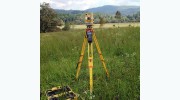
Business Details
21 Years
experience
Your Trusted Geospatial Partner in Asheville, NC
Holmes Geospatial has been a trusted leader in geospatial services since 2005, delivering precise data solutions for construction, real estate, and infrastructure projects. Our team combines advanced technologies like 3D laser scanning and GIS with decades of collective expertise to provide actionable insights for clients across the Southeast. We specialize in boundary surveys, subsurface utility investigations, and reality capture, ensuring accuracy and compliance with regional regulations. Our commitment to innovation and client-centric service has earned recognition, including the Sky High Growth Award from the Asheville Area Chamber of Commerce. With offices in North Carolina and South Carolina, we serve clients in diverse industries, from urban planning to environmental management.Our ISO-certified processes and use of cutting-edge tools like UAS and SLAM technology position us as pioneers in the field. We prioritize transparency, ethical standards, and long-term partnerships, ensuring clients receive reliable data that informs critical decisions. Our team of licensed professionals, including certified GIS specialists and subsurface utility investigators, brings unparalleled expertise to every project. By maintaining deep knowledge of local laws and industry trends, we consistently exceed client expectations for quality and precision. From initial data collection to final deliverables, Holmes Geospatial remains dedicated to advancing geospatial science while honoring the legacy of our founder, Ed Holmes.

Services
Geomatics
Construction Services
GIS Mapping
Remote Sensing
Subsurface Utility Investigation
Details
- Year established: 2005
Highlights and features
- We offer 20+ years of experience in geospatial data solutions.
- Our team utilizes cutting-edge technologies like 3D laser scanning and UAS.
- We provide customized GIS implementations for improved data visualization.
- Our subsurface utility investigations mitigate project risks with GPR technology.
- We serve clients across five states with region-specific regulatory expertise.
Services
Geomatics
Our geomatics services provide precise boundary surveys, topographic assessments, and ALTA/Land Title surveys using traditional techniques and advanced tools. Clients receive accurate spatial data for site planning, legal documentation, and infrastructure development. These services ensure compliance with regional regulations while supporting informed decision-making for construction and land management projects.
Construction Services
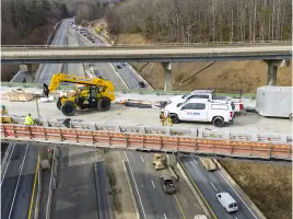
Construction surveying ensures project accuracy through layout marking, 3D modeling, and as-built documentation. Our team uses machine control and site calibration to align structures with engineering plans, minimizing errors and preventing costly rework. These services support high-quality outcomes for roads, utilities, and commercial developments across the Southeast.
Remote Sensing
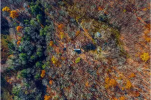
Remote sensing services utilize drones, 3D laser scanning, and photogrammetry to create detailed digital models of physical environments. These technologies enable efficient data collection for terrain mapping, structural analysis, and progress monitoring. Clients benefit from enhanced visualization and risk mitigation for complex infrastructure and environmental projects.
Subsurface Utility Investigation
Subsurface utility investigations identify underground infrastructure using ground-penetrating radar and electromagnetic tools. Our services cover public and private utilities, including gas lines, irrigation systems, and abandoned pipes. This critical data helps clients avoid damages, comply with regulations, and plan safe excavation or construction activities.
GIS Mapping
GIS mapping services organize and visualize spatial data through customized geodatabases and interactive dashboards. Our solutions support infrastructure management, market analysis, and emergency planning by transforming raw data into actionable insights. Clients access secure, real-time information for improved operational efficiency and strategic decision-making.
People
Joshua E. Holmes
President
Joshua E. Holmes leads Holmes Geospatial with a focus on innovation and client satisfaction. He oversees strategic growth while maintaining the company's commitment to precision and ethical standards in geospatial services.
Jason N. Gasperson
Director of Business Development
Jason N. Gasperson drives business growth by connecting clients with tailored geospatial solutions. His expertise in industry trends ensures Holmes Geospatial remains a leader in surveying and data visualization technologies.
Svitlana Eadie
Human Resources Director
Svitlana Eadie manages talent development and company culture at Holmes Geospatial. She ensures the team maintains high professional standards while fostering a collaborative environment aligned with organizational values.
Logan Woodie
Construction Team Lead
Logan Woodie oversees construction surveying operations, ensuring accuracy in layout and documentation. His technical expertise supports complex projects with machine control systems and 3D modeling solutions.
J. Dallas Gordon
Geomatics Team Leader
J. Dallas Gordon leads the geomatics division, delivering boundary surveys and topographic assessments. His team specializes in ALTA/Land Title surveys and subdivision mapping to meet diverse client needs.
Questions
What geospatial services does Holmes Geospatial offer?
We provide land surveying, GIS mapping, remote sensing, and subsurface utility investigations using advanced technologies for construction, infrastructure, and environmental projects.
Which areas do you serve?
We operate across North Carolina, South Carolina, Tennessee, and surrounding regions with offices in Asheville, Hickory, Cashiers, and Greenville.
How do you ensure data accuracy?
We combine traditional surveying methods with cutting-edge tools like 3D laser scanning, UAS, and ground-penetrating radar for precise, reliable results.
Can you handle complex construction projects?
Yes, our construction surveying services include machine control, as-built documentation, and settlement monitoring to ensure alignment with design specifications.
Are your team members certified?
Our professionals include licensed land surveyors, GIS specialists, and subsurface utility investigators with decades of combined industry experience.
How do I request services?
Contact us via phone at 828.225.6562 or through our website form to discuss your project requirements with our team.
Reviews (1)
Tlsolesby
May 29, 2021
Report
A close friend of mine had a hard fall, face first, onto the pavement. Driver pulled over and rendered aid and helped her get in touch with her husband and I. He had to have had some EMT/First responder experience. Didn't get his name, but kudos to him