
Business Details
50+ Years
experience
Civil Engineering and Land Surveying Services in Honolulu
Founded in 1963, Sam O Hirota has established itself as a leader in civil engineering and land surveying across Hawaii, the Trust Territories, and the South Pacific. With over six decades of experience, the firm combines cutting-edge technologysuch as 3D laser scanning, LiDAR, and UAV aerial mappingwith traditional engineering and surveying principles to deliver precise, reliable solutions. Our team has executed diverse projects for federal, state, and local governments, as well as private sector clients, ranging from infrastructure development to historical preservation.Recognized with the American Council of Engineering Companies Hawaii Grand Conceptor Award, we prioritize innovation, accuracy, and client satisfaction. Our deep local expertise and commitment to integrating advanced methodologies ensure projects are completed efficiently and to the highest standards. We serve as trusted partners for clients seeking to engineer, survey, and document the unique landscapes of Hawaii and the Pacific Rim.
Services
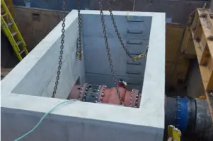
Civil Engineering
Land Surveying
ALTA Surveys
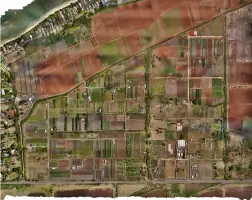
Aerial LiDAR
3D Laser Scanning
3D City Scanning
Scan to BIM
Details
- Year established: 1963
Highlights and features
- We have over 60 years of experience in civil engineering and land surveying in Hawaii.
- Our team integrates advanced 3D scanning and UAV technology with traditional methods.
- We serve federal, state, and local government clients, as well as private-sector partners.
- Our projects emphasize accuracy, efficiency, and adherence to industry standards.
- We hold a proven track record in complex projects, including infrastructure and historical documentation.
Services
Civil Engineering
Sam O Hirota provides comprehensive civil engineering services, including master planning, drainage studies, FEMA permitting, and infrastructure design. Our expertise ensures projects meet regulatory standards while addressing client-specific needs. With decades of experience, we deliver cost-effective, timely solutions for roads, utilities, and public works.
Land Surveying
Our land surveying services encompass boundary analysis, topographic mapping, and ALTA surveys. Utilizing advanced tools like RTK GPS and 3D laser scanners, we ensure survey-grade accuracy. Projects range from residential lots to large-scale government installations, emphasizing precision and reliability.
Aerial LiDAR
Aerial LiDAR and photogrammetry services capture high-resolution geospatial data for terrain analysis and 3D modeling. Our UAV operations support infrastructure planning, volumetric calculations, and asset inspections, combining aerial data with ground verification for comprehensive results.
3D Laser Scanning
3D laser scanning creates detailed digital twins of buildings and sites. Applications include historical preservation, MEP modeling, and urban planning. Our scanners capture millions of data points, enabling precise documentation and change detection for maintenance and development projects.
Scan to BIM
Scan-to-BIM converts laser-scanned point clouds into intelligent Revit models for building management. This process supports facility maintenance, retrofitting, and asset tracking. Partnering with specialists, we ensure models reflect real-world conditions for government and private clients.
Questions
What civil engineering services does Sam O. Hirota offer?
We provide master planning, drainage studies, FEMA permitting, infrastructure design, and regulatory compliance for roads, utilities, and public works projects.
Do you specialize in land surveying for large-scale projects?
Yes, we conduct boundary analysis, topographic mapping, and ALTA surveys for government and private clients, including 124,000-acre US Army installations.
How does your 3D laser scanning technology work?
Our scanners capture billions of data points to create accurate digital twins, used for historical preservation, urban planning, and facility management.
Can you assist with UAV aerial mapping?
Yes, we use UAVs for LiDAR and photogrammetry, supporting terrain analysis, volumetric calculations, and asset inspections with ground verification.
What is Scan-to-BIM, and how is it used?
Scan-to-BIM converts laser scans into Revit models for building management, enabling precise documentation for maintenance and retrofitting projects.