
Business Details
50+ Years
experience
Expert Surveying and Mapping Services in Honolulu
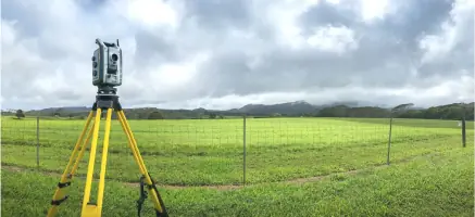
Since 1950, Walter P Thompson has been a trusted leader in surveying and mapping services across Hawaii. Founded by Walter P Thompson and now led by his son James R. Thompson, our firm combines over 70 years of experience with cutting-edge technology to deliver precise and reliable solutions. We specialize in boundary surveys, ALTA/NSPS land title surveys, 3D laser scanning, topographic surveys, and construction surveys, serving residential and commercial clients throughout the Hawaiian Islands. Our commitment to excellence is reflected in our meticulous attention to detail, adherence to evolving industry standards, and dedication to client satisfaction.With a team of licensed professionals and decades of local expertise, we handle complex projects ranging from shoreline certifications to volumetric surveys for mining operations. Our mission remains unchanged since our founding: to provide unparalleled service through disciplined techniques, continuous learning, and a relentless focus on meeting client needs. This enduring philosophy has earned us a broad client base and a reputation as one of Hawaii's most respected surveying firms.
Services
Boundary Surveys
ALTA/NSPS Surveys
3D Laser Scanning
Topographic Surveys
Construction Surveys
Shoreline Certification
Flood Elevation Certification
Volumetric Surveys
Details
- Year established: 1950
Highlights and features
- We offer 70+ years of surveying experience in Hawaii's unique terrain
- Our team includes licensed professionals with local expertise
- We utilize advanced 3D laser scanning technology for precise measurements
- We handle complex shoreline certification processes directly with state agencies
- Our services cover all Hawaiian Islands from a single point of contact
Services
Boundary Surveys
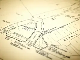
We conduct comprehensive boundary surveys for residential and commercial properties, including K-2 and K-1 surveys required by Hawaii Real Estate Purchase Contracts. Our team handles both general purpose surveys and specific boundary needs, ensuring accurate property line determinations for conveyances and legal documentation. With decades of experience across Hawaii's diverse terrain, we provide reliable boundary solutions for landowners and real estate professionals.
ALTA/NSPS Surveys
Our ALTA/NSPS Land Title Surveys meet the Minimum Standard Detail Requirements for commercial property transactions. We perform these detailed surveys across all Hawaiian islands, providing the precise measurements and documentation required for title insurance and property transfers. Our expertise ensures compliance with industry standards while addressing specific client needs for complex commercial developments and property acquisitions.
3D Laser Scanning
We offer advanced 3D laser scanning services for as-built documentation and design purposes. Our point cloud technology captures precise spatial data for construction projects, architectural documentation, and engineering analysis. This cutting-edge solution provides detailed digital representations of existing conditions, supporting accurate planning and development across various industries throughout Hawaii.
Topographic Surveys
Our topographic surveys cover diverse Hawaiian landscapes from urban centers to remote mountainous regions. We map elevation changes, natural features, and man-made structures to create detailed site plans for development projects. This critical data supports construction planning, environmental assessments, and land management decisions across residential, commercial, and government sectors.
Shoreline Certification
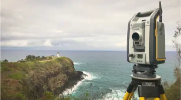
We specialize in certified shoreline surveys through direct collaboration with Hawaii state agencies and coastal experts. Our process includes boundary determination, documentation, and official certification required for coastal properties. While acknowledging the 3-6 month timeline for these complex surveys, we manage the entire process from start to finish, ensuring compliance with state regulations and accurate shoreline records.
People
James R. Thompson
President
Licensed Professional Land Surveyor with over 40 years of leadership experience. Succeeded his father in 1976 after military service and academic training. Active in professional organizations and community education initiatives.
David M. Thompson
President
Co-leader of the firm's operations, maintaining the family legacy of precision surveying established in 1950. Works closely with clients to ensure quality service delivery across all project types.
John R. K. Akina
Vice President
Licensed Professional Land Surveyor supporting the firm's technical operations. Contributes expertise in boundary determination and mapping solutions for Hawaii's unique geographical challenges.
Jeffrey R. Lucas
Senior Draftsman
Experienced technical specialist creating detailed survey drawings and documentation. Provides critical support for boundary surveys, construction projects, and mapping requirements across the islands.
Shannon K. Wright
Construction Project Manager
Manages surveying components for construction projects from initial layout to final certifications. Coordinates field operations and client communications for development projects throughout Hawaii.
Questions
What types of surveying services do you offer?
We provide boundary surveys, ALTA/NSPS land title surveys, 3D laser scanning, topographic surveys, construction surveys, shoreline certifications, and flood elevation certifications across Hawaii.
Do you serve all Hawaiian islands?
Yes, our services cover all Hawaiian Islands including Oahu, Maui, Big Island, Kauai, Molokai, and Lanai from our Honolulu headquarters.
What is your experience with shoreline certifications?
We have extensive experience handling shoreline certification processes directly with state agencies, managing projects from start to finish with typical timelines of 3-6 months.
Are your surveyors licensed?
Yes, our team includes Licensed Professional Land Surveyors (LPLS) with decades of combined experience in Hawaii's unique surveying requirements.
How long have you been in business?
We've been providing surveying services since 1950, celebrating over 70 years of continuous operation in Hawaii.
Reviews (1)
Keith I.
Dec 08, 2018
Report
We needed a basic boundary staking of our lot for some driveway and wall improvements. After receiving ambiguous answers from a couple of other firms, I contacted Walter P. Thompson via their website. (Their website is very nicely done and evokes a professionalism borne out in their services). I received a written proposal via email the following day, and the work was completed within 2 weeks. They were very responsive by email, even at odd hours, and worked with our contractor to make sure they performed the necessary survey (and nothing unnecessary). Very pleased with the service we received, mahalo!