
Business Details
Trusted Land Surveying and Engineering Services in NC & VA
Cardinal Civil Resources is a full-service land surveying and engineering company dedicated to delivering precise and reliable solutions for residential, commercial, and governmental clients. With operations in North Carolina and Virginia, we specialize in land surveying, engineering, land planning, and 3D imaging services. Our team of seasoned professionals brings decades of combined experience to every project, utilizing cutting-edge technology to ensure accuracy and efficiency. We serve a diverse clientele including homebuilders, general contractors, government agencies, and homeowners, with a proven track record of completing complex projects on time and within budget. Our commitment to quality is reflected in our long-standing relationships with industry leaders and our ability to consistently exceed client expectations.From property stakeouts to comprehensive building materials testing, we provide end-to-end solutions tailored to meet specific project requirements. Our recent acquisition by ZenaTech, Inc. has further enhanced our capabilities through integration of advanced AI drone and quantum computing technologies. We take pride in our community involvement, demonstrated through initiatives like our annual support for The Arc of Greater Williamsburg. With five strategically located offices, we combine local expertise with nationwide resources to deliver exceptional service across our service areas. Our leadership team, featuring industry veterans with over 30 years of experience, ensures that every project receives the technical expertise and personal attention necessary for success.
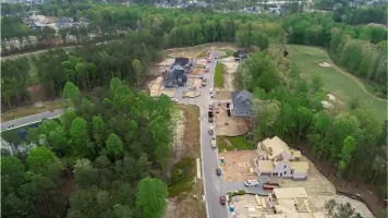
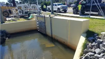
Services
Land Surveying
Land Planning
Engineering
3D Imaging
Storm Drainage Design
Site Plans
Stream Restoration
Erosion Control
Flood Elevation Certificates
Rezoning Services
Highlights and features
- We offer over 30 years of combined experience in land surveying and engineering
- Our team utilizes the latest technology for accurate surveying and mapping
- We provide comprehensive services from property stakeouts to stormwater management
- Our clients include the 4th largest homebuilder in the United States
- We serve multiple locations across North Carolina and Virginia with local expertise
What people say
On time delivery
Error-free services
Advanced technology
Experienced professionals
Comprehensive solutions
Services
Land Surveying
Our surveyors use the latest technology to create accurate surveys, maps, and stakeouts for residential, commercial, and infrastructure projects. We provide property stakeouts, boundary determinations, and topographic mapping services that ensure precise land development. Our team delivers error-free documentation for construction projects ranging from single-family homes to multi-million dollar infrastructure developments.
Engineering
Our engineering team works with clients to design site features, manage erosion control, and develop stormwater management systems. We provide feasibility studies, flood elevation certifications, and special use permit assistance to help clients maximize property investments while meeting regulatory requirements through comprehensive site planning solutions.
Stream Restoration
We specialize in converting agricultural land to wetlands and restoring natural waterways through precise grading and drainage solutions. Our services include establishing stream centerlines, determining disturbance limits, and creating sustainable drainage infrastructure that addresses flooding issues while maintaining environmental compliance for municipal and private clients.
3D Imaging
We utilize advanced 3D imaging technology to create detailed digital representations of project sites for improved planning and visualization. This technology enhances accuracy in property stakeouts, supports complex engineering designs, and provides clients with interactive models to better understand project scope and implementation timelines.
Storm Drainage Design
Our engineers design comprehensive stormwater management systems that address flooding issues and meet regulatory requirements. We provide analysis, design, and implementation services for drainage infrastructure including storm sewers, detention ponds, and channel improvements that protect properties and improve water flow management.
People
George Cunha
President and Founder
George Cunha is the visionary founder of Cardinal Civil Resources with 30 years of experience in the land surveying industry. He established the company's commitment to technical excellence and client satisfaction that continues today.
Don Rudy
VP Business Development
Don Rudy leads new client development and strategic acquisitions while ensuring continuous growth and improvement of Cardinal's service offerings to meet evolving industry demands.
Holly Weaver
Operations & Finance Manager
Holly Weaver manages Cardinal's financial operations, ensuring the company maintains strong fiscal health while delivering quality services that meet both client needs and financial standards.
Blaise Burry
Williamsburg Surveyor
Blaise Burry is a land surveyor with nearly 50 years of experience and recognized as our surveying technology expert, bringing extensive knowledge of modern surveying techniques and equipment to every project.
Bob Medford
Charlotte Surveyor
Bob Medford is a professional land surveyor with 45 years of experience, licensed in North and South Carolina, providing expert surveying services for complex commercial and infrastructure projects.
Questions
What services does Cardinal Civil Resources offer?
We provide land surveying, engineering, land planning, 3D imaging, storm drainage design, site plans, stream restoration, and erosion control services for residential, commercial, and government clients.
Which areas do you serve?
We operate throughout North Carolina and Virginia with offices in Charlotte, Manassas, Richmond, Waynesboro, and Williamsburg.
What makes Cardinal different from competitors?
Our combination of 30+ years' experience, cutting-edge technology, and acquisition by AI technology leader ZenaTech provides unique capabilities in surveying accuracy and project efficiency.
Do you work with both large and small clients?
Yes, we serve clients of all sizes including major homebuilders, government agencies, contractors, and individual homeowners across multiple project types.
How do you handle complex infrastructure projects?
Our engineers and surveyors collaborate using advanced technology to manage challenges like traffic flow improvements, flood mitigation, and stream restoration in both urban and rural environments.
Videos
Reviews (2)
Susan Krancer
Jun 03, 2020
Report
This company is not responsive. They have really put us in a bind with one of our real estate deals by not responding when I thought they had us on their schedule. They may do fine work, but they get an F from me on communication.
Joshua Boone
Nov 08, 2019
Report
Garbage company, improper layout of column lines and surveyer was rude to the customer. I'd give them a zero if I could.
