Business Details
26 Years
experience
Professional Land Surveying Services
Muir Consulting was founded in 2000 by Jack M. Smith, a licensed land surveyor with expertise in surveying engineering. Our company was established to deliver high-quality surveying solutions across California, expanding operations to Nevada while maintaining cost-effective services. We leverage cutting-edge technology, including robotic instruments, GPS, and 3D laser scanning, to address conventional and unconventional projects efficiently. Our commitment to sustainability drives our use of green technologies, alternative energy, and recycling practices. We specialize in topographic surveys, environmental surveys, lot line adjustments, boundary surveys, and subdivision mapping, serving diverse industries with precision.Our structured approach ensures clients receive consistent, reliable service across our geographic footprint. We prioritize client satisfaction through transparent communication and tailored solutions for land development needs. Our team's technical proficiency and dedication to innovation position us as a trusted partner for surveying projects of varying complexity. We maintain rigorous quality standards while adapting to evolving industry demands and technological advancements. Clients benefit from our localized expertise combined with scalable capabilities to support regional and statewide projects.

Services
Topographic Survey
Environmental Surveys
Lot Line Adjustments
Boundary Survey
Subdivision Mapping
Easements
Condominium Mapping
Infrastructure Monitoring
Details
- Year established: 2000
Highlights and features
- We have over 20 years of experience in land surveying since 2000
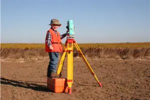
- We utilize robotic instruments, GPS, and 3D laser scanning technology
- We maintain sustainable practices through green technologies and recycling
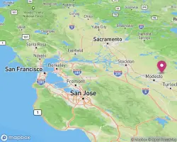
- We serve all of California and Nevada with consistent service quality
- We implement efficient methods for economical surveying solutions
Services
Topographic Survey
Our topographic surveys precisely map natural and man-made features including buildings, trees, waterways, and elevation contours. Architects and engineers rely on these detailed measurements for site planning and development projects. We use advanced technologies like 3D laser scanning and GPS to ensure accuracy for both small and large-scale applications.
Environmental Surveys
We conduct comprehensive environmental surveys locating monitoring wells, soil bores, and vapor wells to meet state requirements. Our team prepares electronic submittals compliant with GeoTracker specifications for regulatory compliance. These surveys support environmental impact assessments and remediation planning using precise field data collection methods.
Lot Line Adjustments
We facilitate lot line adjustments and parcel mergers without creating new lots, following local agency requirements. Our licensed surveyors resolve setback conflicts and prepare legal documentation for property boundary modifications. This service ensures compliance with subdivision regulations while maintaining property value integrity.
Boundary Survey
Our boundary surveys establish precise property lines through historical research and field measurements. We identify easements, encroachments, and legal descriptions to prevent disputes. Clients receive detailed documentation for real estate transactions, development projects, or property management purposes.
Subdivision Mapping
We create subdivision maps for residential and commercial developments following local regulations. Our process includes topographic analysis, infrastructure planning, and legal documentation preparation. This service supports efficient land division while maintaining compliance with municipal zoning requirements.
People
Jack M. Smith
President
President and founder with 20+ years of experience in land surveying. Licensed professional surveyor graduated from California State University, Fresno. Established Muir Consulting in 2000 to provide quality surveying services across California and Nevada.
Questions
What surveying services do you offer?
We provide topographic surveys, environmental assessments, boundary determinations, subdivision mapping, lot line adjustments, easement documentation, and infrastructure monitoring services.
What technology do you use for surveys?
Our equipment includes robotic instruments, GPS systems, 3D laser scanners, and UAV technology to ensure precise and efficient data collection for all survey types.
Which areas do you serve?
We operate throughout California and Nevada, providing consistent service quality across both states for residential, commercial, and government projects.
How can I pay for services?
Payments can be made online through our secure Stripe portal using credit cards. You'll need your job or invoice number to complete transactions.
How do you ensure survey accuracy?
We combine licensed professionals' expertise with advanced technology and rigorous quality control processes to maintain high accuracy standards in all deliverables.