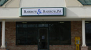
Business Details
47 Years
experience
Your Trusted Land Surveying Experts in Snow Hill, NC
Barrow & Barrow has been a trusted name in professional land surveying since 1979, when Luther Barrow, Jr., PLS, established the firm in Snow Hill, North Carolina. Over four decades, we have grown from a small home-based operation to a respected multi-generational business serving Greene County and surrounding regions. Our expertise spans residential and commercial planning, subdivision development, erosion control, and advanced GPS mapping using cutting-edge technology. With Steve Barrow, PLS, and Darryl Barrow, PLS, leading operations, we combine three generations of local knowledge with modern innovation to deliver precision surveys efficiently. Our commitment to quality, timeliness, and fair pricing has solidified our reputation as the oldest and most reliable survey firm in Greene County. We utilize AutoCAD, Carlson Civil Suite, and Topcon Hiperlite+ GPS systems to produce accurate digital surveys from field to finish.Our service-oriented approach ensures clients receive tailored solutions for boundary disputes, site layouts, environmental assessments, and construction staking. As technology evolves, our team remains at the forefront, integrating software and hardware advancements to streamline workflows and eliminate manual drafting. This dedication to innovation, combined with deep-rooted community expertise, positions us to serve both individual property owners and large-scale developers across Eastern North Carolina. For over 40 years, we have prioritized client satisfaction, ensuring every project meets rigorous standards while maintaining cost-effectiveness and prompt delivery.
Services
Boundary Surveys
Topographic Surveys
Residential Subdivision
Commercial Subdivision
Erosion Control Plans
Storm Water Drainage
Environmental Surveys
Mining Surveys
Site Layout
Computer Drafting
Details
- Year established: 1979
Highlights and features
- Three generations of local surveying expertise since 1979
- State-of-the-art GPS and CAD technology for accuracy
- Timely delivery of surveys with no hidden fees
- Specialized in complex residential and commercial projects
- Oldest survey firm in Greene County, NC
Services
Boundary Surveys
Boundary surveys establish property lines and corners using GPS and traditional equipment. We research historical records, conduct field measurements, and provide legal documentation. Clients receive detailed maps and reports for real estate transactions, disputes, or development planning.
Topographic Surveys
Topographic surveys capture natural and man-made features to create elevation models. We use robotic total stations and GPS to map contours, structures, and vegetation. Results guide construction, drainage projects, and environmental assessments with high accuracy.
Subdivision Design
Subdivision design services include platting residential and commercial lots per local regulations. We handle zoning analysis, utility layout, and erosion control plans. Clients benefit from efficient approvals and site-ready designs for builders and developers.
Erosion Control Plans
Erosion control plans prevent sediment runoff during construction. We design silt fences, vegetative buffers, and stormwater management systems. Compliance with NCDEQ standards ensures permits are approved and environmental impacts minimized.
Computer Drafting
Computer drafting converts field data into digital maps using AutoCAD and Carlson software. We produce site plans, cross-sections, and 3D models for engineers and architects. This streamlines revisions and integrates with construction documentation for precise project execution.
People
Luther Barrow Jr.
Founder & Consultant
Luther Barrow Jr., PLS, established the firm in 1979 and served as its leader for over 25 years. His foundational expertise in Greene County land records and boundary law continues to guide our team's precision and client focus.
Steve Barrow
President & PLS
Steve Barrow, PLS, oversees daily operations and fieldwork execution. With decades of experience, he specializes in boundary resolution and construction staking, ensuring adherence to state standards and client timelines.
Darryl Barrow
Technology Director & PLS
Darryl Barrow, PLS, manages software integration and digital workflows. His computer science background enables us to leverage AutoCAD, Carlson, and GPS systems for efficient, paperless survey production.
Questions
What services does Barrow & Barrow offer?
We provide boundary surveys, topographic mapping, subdivision design, erosion control plans, construction staking, and environmental surveys using GPS and CAD technology.
Which areas do you serve?
We operate primarily in Greene, Lenoir, Pitt, Wayne, Wilson, Craven, and Onslow counties in Eastern North Carolina.
How long has Barrow & Barrow been in business?
Since 1979, making us the oldest land surveying firm in Greene County with three generations of experience.
What technology do you use for surveys?
We utilize Topcon Hiperlite+ GPS systems, AutoCAD, Carlson Civil Suite, and robotic total stations for precise digital mapping.
Can you handle both residential and commercial projects?
Yes, we specialize in residential subdivisions, commercial site layouts, and large-scale development surveys.