
Business Details
14 Years
experience
Emergency
services
Your Trusted Partner for Geospatial Surveying Solutions
At SAM, we deliver fast, accurate geospatial data to empower clients to advance their programs with confidence. With over 13 years of recognition in the industry, our teams deploy within 24 hours to collect data ranging from land surveys to digital insights, leveraging advanced technologies like LiDAR and GIS. Our expert consulting teams transform raw data into strategic assets, supporting infrastructure projects across utilities, transportation, government, and natural resources sectors. Recognized as a Top Workplace in Charlotte and Long Island, we foster a culture of collaboration, innovation, and inclusion.Our commitment to safety, precision, and client-centric solutions ensures we meet the unique demands of projects from local route surveying to multibillion-dollar initiatives. By combining national reach with localized expertise, we provide tailored geospatial services that drive sustainable energy solutions, efficient public projects, and critical infrastructure development.
Services
Land Surveying
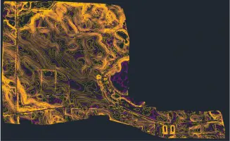
Aerial Mapping
GIS
BIM/3D Laser Scanning
Damage Prevention
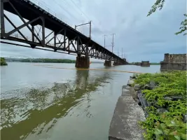
Engineering Inspection
Powerline Inspection
Substation Digital Twins
Subsurface Utility Engineering
Utility Coordination
Details
- Year established: 2012
Highlights and features
- We deploy teams within 24 hours for rapid data collection.
- Our advanced technologies ensure precise geospatial data.
- Expert consulting teams turn data into strategic assets.
- Recognized as Top Workplaces in multiple regions.
- Committed to a culture of collaboration and innovation.
Services
Land Surveying
SAM provides precise land surveying services using state-of-the-art technologies to support infrastructure development. Our solutions enhance project accuracy, reduce risks, and ensure compliance with regulatory standards. Clients benefit from rapid deployment and data-driven insights tailored to their specific needs.
Aerial Mapping
Our aerial mapping services utilize high-density LiDAR and imagery to capture detailed site data. This enables efficient planning, design, and monitoring of transportation, utility, and construction projects. Advanced tools ensure faster data acquisition and actionable insights for complex developments.
Subsurface Utility Engineering
SAMs subsurface utility engineering minimizes risks by identifying and mapping underground infrastructure. This service supports safe excavation, reduces project delays, and ensures accurate coordination for utilities and construction projects.
Powerline Inspection
Our powerline inspection solutions use cutting-edge technology to assess infrastructure integrity. Proactive inspections help prevent outages, ensure compliance, and extend asset lifespans for electric power and renewable energy clients.
GIS Consulting
SAM offers strategic GIS consulting to integrate geospatial data into enterprise systems. Our expertise helps clients optimize asset management, improve decision-making, and leverage digital twins for smarter infrastructure planning.
Questions
What geospatial services does SAM offer?
SAM provides land surveying, aerial mapping, GIS consulting, subsurface utility engineering, powerline inspection, and BIM/3D laser scanning services.
How quickly can SAM deploy teams for data collection?
SAM teams can deploy within 24 hours to begin collecting geospatial data for projects of any scale.
What industries does SAM support?
We serve utilities, transportation, government, and natural resources sectors with tailored geospatial solutions.
Does SAM use advanced technologies for data capture?
Yes, we utilize LiDAR, GIS, and high-density aerial imaging to ensure precise and efficient data collection.
Has SAM received industry recognition?
SAM has been named a Top Workplace in Charlotte and Long Island and ranks #89 on ENR’s 2025 Top 500 Design Firms list.
Reviews (1)
Marty Piecyk
Mar 06, 2021
Report
I wouldn't know how great their service is, because they still haven't responded to my email or voicemail from 2 months ago. If they're too busy or don't do residential surveys, I would appreciate being contacted back.