
Business Details
Land Surveying & Aerial Mapping Experts in Virginia
Lincoln Surveying is driven by the core values of Innovation, Integrity, and Vision to deliver expert land surveying and aerial mapping services across Virginia. Our team of professional land surveyors, GIS analysts, and licensed remote pilots combines decades of experience with cutting-edge LiDAR drone technology to execute boundary, ALTA, topographic, and construction surveys with precision. Since 1991, we have served public and private clients including the University of Virginia, Albemarle County, and Charlottesville, providing certified deliverables such as point cloud data, imagery, and grading performance certifications.Our FAA-certified pilots and technical staff ensure every project meets rigorous industry standards while maintaining transparent communication with clients throughout the process. We specialize in serving engineers, architects, developers, government agencies, and utility companies through reliable, technology-driven solutions that save time and enhance project outcomes.

Services
Land Surveying
Aerial Mapping
Topographic Surveys
Boundary Surveys
ALTA Surveys
Construction Surveys
LiDAR Mapping
Tree Canopy Surveys
As-Built Surveys
Grading Certification
Highlights and features
- We offer 30+ years of experience in Virginia land surveying since 1991
- Our FAA-certified drone pilots use LiDAR technology for precise mapping
- We serve major institutions like the University of Virginia and Albemarle County
- Our team includes professional land surveyors and GIS analysts with specialized certifications
- We provide certified deliverables including point cloud data and grading performance reports
Services
Land Surveying
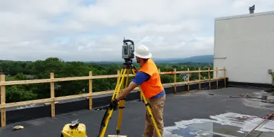
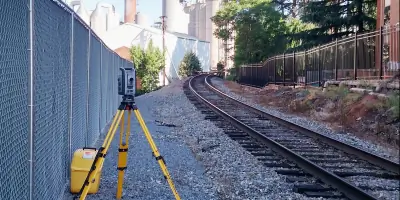
Our professional land surveyors execute boundary, ALTA, and construction surveys with precision. Using advanced equipment and decades of experience, we deliver certified documentation for property development, legal compliance, and infrastructure projects across Virginia. Our services support engineers, attorneys, and government agencies with accurate spatial data.
Aerial Mapping
We provide LiDAR-enabled aerial mapping for topographic analysis, tree canopy assessment, and as-built documentation. Our FAA-certified pilots capture high-resolution data to create detailed 3D models and imagery. This technology supports grading performance certification and construction monitoring for diverse clients.
Topographic Surveys
Our topographic surveys use drone and ground-based technology to map elevation changes and natural features. This data supports land development, environmental assessments, and infrastructure planning. Clients receive accurate digital terrain models and contour maps for project design and regulatory submissions.
Construction Surveys
We provide construction layout and monitoring services to ensure projects align with design specifications. Our team uses robotic total stations and GPS technology for precise grading verification and structural positioning. These surveys minimize rework and maintain compliance with local building codes.
LiDAR Mapping
Our LiDAR mapping services capture detailed point cloud data for complex land features and structures. This technology enables accurate volume calculations, vegetation analysis, and building modeling. Deliverables include DWG files and TIF imagery that support engineering, environmental, and urban planning applications.
People
Christopher Kean
President
Professional Land Surveyor with Virginia License 57-17,(3)(a). 30+ years experience in boundary, ALTA, and construction surveys. FAA Part 107 remote pilot and consultant to University of Virginia.
Joe Keller
CSTIII
Certified Survey Technician Level III with extensive field experience. Specializes in data collection and quality control for complex land surveying projects across Central Virginia.
David Sexton
CSTII
Certified Survey Technician Level II supporting field operations and CAD data preparation. Experienced in boundary surveys and construction layout projects.
Victoria Kean
Aerial Mapping
Specializes in drone operations and aerial data processing. FAA-certified remote pilot managing LiDAR and photogrammetry projects for topographic and environmental assessments.
Chip Birdsall
CSTII, STIII
Dual-certified survey technician with expertise in field data collection and office analysis. Supports boundary resolution and construction monitoring projects using advanced surveying equipment.
Questions
What surveying services do you offer in Virginia?
We provide boundary surveys, ALTA surveys, topographic mapping, construction monitoring, and LiDAR-enabled aerial mapping for public and private clients.
Do you serve commercial and residential clients?
Yes, we support engineers, developers, government agencies, utility companies, and private landowners with customized surveying solutions.
What technology do you use for aerial mapping?
Our FAA-certified pilots use LiDAR-equipped drones to capture high-precision topographic data and 3D models for diverse applications.
How long has your team been in business?
Our president has practiced since 1991, and our aerial mapping division has operated since 2022 with experienced technical staff.
Can you handle large-scale infrastructure projects?
Yes, our team has supported major projects for the University of Virginia, Albemarle County, and Charlottesville with precise surveying services.