
Business Details
23 Years
experience
Professional Surveying & Mapping Services in Royal Palm Beach, FL
Founded in 2003, Whidden Surveying & Mapping has established itself as a trusted provider of professional surveying and mapping solutions. Our team includes two licensed surveyors with over 40 combined years of expertise in boundary, hydrographic, topographic, and specialized surveys. We prioritize precision and client satisfaction, offering services tailored to land development, construction, and environmental projects.Our commitment to excellence is reflected in our use of advanced technologies like GPS and laser scanning. We pride ourselves on delivering accurate data while meeting project deadlines, ensuring clients receive reliable results for their specific needs. With a focus on innovation and technical proficiency, we serve both public and private sector clients across diverse industries.
Services
Boundary Surveys
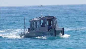
Hydrographic Surveys
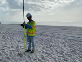
Topographic Surveys
GPS Surveys
Laser Scanning
Construction Layout
Subdivision Platting
Easement Preparation
Horizontal Control
Vertical Control
Details
- Year established: 2003
Highlights and features
- We offer over 40 combined years of surveying experience with licensed professionals.
- Our team specializes in diverse survey types including boundary, hydrographic, and laser scanning.
- We utilize advanced GPS and 3D mapping technologies for precise data collection.
- Our services support construction, land development, and environmental compliance projects.
- We prioritize meeting client deadlines without compromising measurement accuracy.
Services
Boundary Surveys
Boundary surveys precisely define property lines through field measurements and legal document analysis. This service ensures accurate land division for real estate transactions, development projects, and dispute resolution. Clients receive detailed maps and documentation compliant with state surveying standards.
Hydrographic Surveys
Hydrographic surveys map underwater terrain to support navigation, dredging operations, and water resource management. Using specialized sonar equipment, we collect depth measurements and underwater feature data for coastal areas, lakes, and river systems.
Topographic Surveys
Topographic surveys capture natural and man-made land features, including elevation changes and vegetation. This data supports construction planning, environmental assessments, and infrastructure development with detailed terrain models and contour maps.
Laser Scanning
Laser scanning creates high-resolution 3D models of structures and landscapes using LiDAR technology. This service provides precise measurements for building renovations, archaeological documentation, and industrial facility management with millimeter-level accuracy.
Construction Layout
Construction layout services establish precise reference points for building projects using survey-grade equipment. We ensure foundations, utilities, and structures align perfectly with architectural plans, minimizing costly field adjustments during development.
People
Tom Whidden
President
Tom Whidden is a licensed Professional Surveyor with over 20 years of experience in land measurement and mapping. He oversees all survey operations and client relations at Whidden Surveying & Mapping.
Questions
What types of surveying services do you offer?
We provide boundary, topographic, hydrographic, GPS, laser scanning, construction layout, and subdivision platting services for residential, commercial, and municipal projects.
How long has your company been in business?
Whidden Surveying & Mapping has provided professional surveying services since January 2003, with over 40 combined years of experience among our licensed staff.
Do you serve areas outside Royal Palm Beach?
While based in Royal Palm Beach, FL, we serve clients throughout Palm Beach County and surrounding regions for land surveying and mapping projects.
What technologies do you use for surveys?
We utilize GPS systems, LiDAR scanning, total stations, and advanced mapping software to ensure precise data collection and accurate deliverables for all survey types.
Reviews (2)
Andrew Troyer
Nov 26, 2021
Report
Whidden Surveying & Mapping, Inc. We executed the engagement letter with Whidden Surveying & Mapping, Inc. on October 15, 2021 and were told that they would be out within 2-3 weeks to mark the corners of our property. Christina Lilly emailed "I would guesstimate in the next 2-3 weeks but can narrow that down possibly later on this afternoon once we review our schedule." Three weeks later (Nov 5th), the work has not been completed, we are still not on the schedule, and Christina now claims "our project turn around times are an 'estimate', and I should call the office if she doesn't respond". * Poor customer service * Poor business practices * Poor response time They are simply NOT reliable. I can NOT recommend Tom Whidden Surveying & Mapping, Inc. and we will not be using them again.
Joe Trainor
Mar 14, 2016
Report
Whidden Surveying & Mapping has been a pleasure to work with and very professional and prompt with their services. Highly recommended! I needed a rush on a survey and the firm was able to deliver.