
Business Details
31 Years
experience
Your Trusted Land Surveying Partner in Virginia Beach
Precision Measurements, Inc. (PMI) was established in 1995 and has grown into a full-service land surveying firm with over 20 years of proven industry expertise. We are certified by numerous transportation authorities in Virginia and Maryland as a Disadvantaged Business Enterprise (DBE) and Virginia Small, Women, and Minority (SWaM) certified organization. Our services span state, national, and international markets, supported by six strategically located offices in Virginia, Maryland, and Florida. We specialize in topographic, hydrographic, and 3D scanning surveys, utilizing cutting-edge technology to deliver quality products to clients. Our team brings extensive experience working with Department of Transportation entities across the eastern United States. We maintain licenses in 17 states, including Virginia, Maryland, Florida, and California, ensuring broad service capabilities. Our commitment to Title VI compliance underscores our dedication to nondiscrimination in all programs and activities. With advanced equipment and methodologies, we provide precise mapping of ground contours, subsurface utilities, and digital hydrographic data. Our unmanned aerial systems (UAS) services offer innovative solutions for orthomosaics, stockpile volumes, and infrastructure inspections. Backed by decades of experience and technical excellence, we serve as a trusted partner for government and private sector clients requiring accurate surveying solutions.
Services
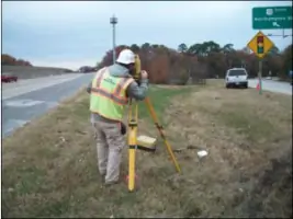
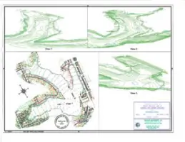
Topographic Surveying
3-D Scanning
Hydrographic Surveys
DOT Surveying
UAS Services
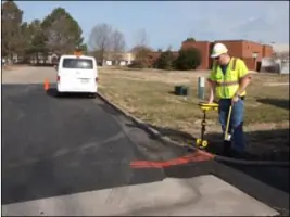
Subsurface Utility Designation
Served areas
- Virginia, West Virginia, Maryland, Delaware, Pennsylvania, North Carolina, District of Columbia, New York, Florida
Details
- Year established: 1995
Highlights and features
- We have over 20 years of experience in land surveying.
- Our team holds DBE and Virginia SWaM certifications.
- Licensed to operate in 17 states across the US.
- We utilize advanced 3D scanning and UAS technologies.
- Specialized expertise in DOT projects and hydrographic surveys.
Associations and certifications
- DBE
- Virginia SWaM
Services
Topographic Surveying
Our topographic surveying services identify and map ground contours and existing features with precision. Using conventional methods and advanced equipment, we deliver detailed data for infrastructure projects, land development, and environmental assessments. This service supports DOT agencies and government organizations requiring accurate terrain documentation.
3-D Scanning
High-definition 3D scanning creates detailed digital representations of physical environments. Our technology captures millions of data points to produce precise models for construction, historical preservation, and industrial applications. This state-of-the-art solution enhances project visualization and decision-making processes.
Hydrographic Surveys
We provide full-service hydrographic surveys using digital multibeam and single beam systems. Our expertise includes underwater terrain mapping, navigation channel assessments, and coastal engineering projects. This critical data supports maritime infrastructure and environmental monitoring initiatives.
DOT Surveying
Specialized surveying services for Department of Transportation projects across the eastern US. Our experience includes route surveys, right-of-way mapping, and construction staking for highways and infrastructure. We maintain certifications and licenses to meet federal and state transportation agency requirements.
UAS Services
Unmanned aerial systems capture aerial data for orthomosaics, stockpile volumes, and infrastructure inspections. Our FAA-certified pilots operate advanced drones to collect high-resolution imagery and point cloud data. This technology provides cost-effective solutions for large-area surveys and progress monitoring.
Questions
What surveying services does Precision Measurements offer?
We provide topographic, hydrographic, 3D scanning, DOT, and UAS services, along with subsurface utility designation and digital mapping solutions.
In which states are you licensed to operate?
We hold licenses in Virginia, Maryland, Florida, and 14 additional states across the eastern and central United States.
Are your surveyors certified for government projects?
Yes, we are DBE-certified and Virginia SWaM-certified, meeting requirements for transportation and public infrastructure projects.
What technologies do you use for accurate surveys?
We employ 3D laser scanning, multibeam sonar, UAS drones, and conventional surveying equipment to ensure precision across all projects.
Reviews (1)
Greg Johnson
Nov 26, 2019
Report
One of their drivers tried to run me off the road today 12/24/2019 in Portsmouth. Even with me blowing my horn they kept coming into my lane forcing me on the curb. Pretty sure it was truck 57. Stay away from this company especially this truck!