
Business Details
12 Years
experience
Professional Land Surveying Services in Waterford, PA
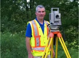
Established in 2014, A.R.E.A. Surveying has dedicated itself to delivering high-quality land surveying services with professionalism and efficiency. With over two decades of experience in boundary, construction, and topographic surveying, our team approaches each project with meticulous attention to detail and a commitment to client satisfaction. Our founder, Allen Yard, holds a B.S. in Mathematics and Education from Grove City College and has been an active member of the Pennsylvania Society of Land Surveyors since obtaining his Professional Land Surveyor license in 2005. We specialize in boundary surveys, construction layout, elevation certificates, and stormwater management design, among other services. Our remote operations since 2020 ensure continued accessibility while maintaining our Waterford, Pennsylvania base. We prioritize clear communication and client education, guiding clients through the surveying process with transparency and expertise. Our extensive experience includes ALTA surveys, gas well plats, and as-built documentation, serving both public and private sector needs. We maintain active membership in the National Society of Professional Surveyors to stay current with industry advancements. Our goal remains unchanged since inception: to meet client needs through timely, accurate, and professional service delivery.
Services
Boundary Surveys
Construction Layout
Topographic Mapping
Elevation Certificates
ALTA Surveys
Gas Well Plats
Stormwater Design
As-Built Documentation
Served areas
- Erie County, Warren County, Crawford County, Venango County, Mercer County, Forest County, Pennsylvania
Details
- Year established: 2014
Highlights and features
- We offer over 20 years of professional land surveying experience.
- Our team maintains active membership in state and national surveying societies.
- We provide customized solutions for boundary, construction, and environmental surveys.
- Our remote operations ensure continued service accessibility without compromising quality.
- We prioritize client education and transparent project communication.
Associations and certifications
- Pennsylvania Society of Land Surveyors (PSLS)
- National Society of Professional Surveyors
Services
Boundary Surveys
Our boundary surveys precisely determine property lines using advanced equipment and historical records. We deliver detailed documentation for legal transactions, disputes, or development planning. Clients receive clear graphical representations and written descriptions of their land parcels.
Construction Layout
We provide accurate construction layout services for buildings, roads, and utilities. Our team establishes reference points and elevations to guide contractors during development. This ensures compliance with design specifications and zoning requirements throughout the building process.
Topographic Mapping
Our topographic surveys capture natural and man-made features with elevation data. These detailed maps support site planning, engineering design, and environmental assessments. We use modern technology to produce precise three-dimensional representations of project areas.
Elevation Certificates
We complete elevation certificates for floodplain management and insurance purposes. Our surveys determine building elevations relative to flood risk zones. This documentation helps property owners meet regulatory requirements and obtain accurate flood insurance rates.
ALTA Surveys
Our ALTA/ACSM land title surveys meet national standards for commercial property transactions. These comprehensive surveys identify boundary details, improvements, and encumbrances. Clients receive detailed maps with title company-approved documentation for real estate closings.
Questions
What surveying services do you offer?
We provide boundary surveys, construction layout, topographic mapping, elevation certificates, ALTA surveys, gas well plats, stormwater management design, and as-built documentation for residential and commercial clients.
Are you currently operating in Waterford?
Yes, we remain based in Waterford, Pennsylvania. While we vacated our High Street office in 2020, we continue serving clients remotely and maintain our P.O. Box 93 mailing address.
What experience does your team have?
Our principal surveyor has over 20 years of field experience, including boundary determination, construction layout, and environmental surveys. Licensed since 2005, we combine technical expertise with membership in professional state and national organizations.
Can you handle complex surveying projects?
Yes, we manage complex projects including ALTA/ACSM standards surveys, stormwater management designs, and gas well platting. Our experience covers boundary disputes, subdivision plats, and construction monitoring for both public and private sectors.
Reviews (3)
Megan Collins
Jun 25, 2022
Report
Allen is professional, knowledgeable, and thorough. He had options that made the survey affordable. I highly recommend A.R.E.A Survey.
Over The Hill & Far Away Mountaintop
Nov 19, 2017
Report
Stopped into the office and discussed having my property surveyed back in 2017. Was told I would hear back from him within a few weeks. About two months went by and nothing. Spoke with him again and he told me he would be in contact soon. Never heard from him again. While he was friendly that did not get my property surveyed. If you can't or do not want to do a job just say so rather than stringing along a client.
Henry Oldach
Jan 11, 2017
Report
Allen has done a few different jobs for me, and has always been accurate, responsive, and very professional. His rates are good, and he is very thorough in his work. I would highly recommend A.R.E.A Surveying.