Business Details
50+ Years
experience
Civil Engineering & Land Surveying Experts
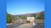
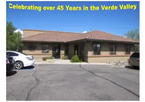
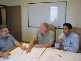
Since 1974, SEC has established itself as a progressive civil engineering, surveying, and land planning firm committed to excellence. Headquartered in Sedona, Arizona, with offices in Cottonwood, Prescott, and Council, Idaho, we specialize in providing comprehensive solutions for land utilization and development. Our multidisciplinary team combines expertise in civil engineering, structural engineering, land surveying, GIS mapping, and environmental planning to deliver innovative, cost-effective designs tailored to client needs. With over 5,900 projects completed across 22 states, our success stems from a team-oriented approach and adherence to the highest professional and ethical standards. We prioritize understanding regional challenges, maintaining positive relationships with municipal agencies, and integrating communication, teamwork, and quality into every project.Our mission focuses on improving efficiency while safeguarding public health, safety, and environmental stewardship. Through decades of experience, we offer technical expertise in floodplain evaluations, no-rise certifications, and natural resource management, supported by advanced technologies like GPS and GIS. Our vision emphasizes innovation, environmental responsibility, and transforming client ideas into reality. With a vast archive of historical data dating back to the 1800s, we provide responsive, personalized attention to ensure project success for private, municipal, and government clients.
Services
Land Surveying
Civil Engineering
Land Planning
Floodplain Evaluations
Forestry Analysis
Details
- Year established: 1974
Highlights and features
- We offer 50+ years of experience in civil engineering and land surveying.
- Our team combines multidisciplinary expertise in engineering, surveying, and environmental planning.
- We maintain long-standing relationships with municipal agencies for efficient project approvals.
- Our work incorporates advanced technologies like GIS mapping and GPS surveys.
- We provide tailored solutions for federal, state, and private sector clients.
Services
Land Surveying
SEC provides precise land surveying services including boundary determination, topographic mapping, and GPS data collection. Our team uses advanced technologies to ensure accuracy for residential, commercial, and government projects. We support infrastructure development, property disputes, and environmental assessments.
Civil Engineering
Our civil engineering services cover infrastructure design, stormwater management, and utility planning. We create compliant, cost-effective solutions for roadways, water systems, and wastewater treatment facilities. Projects integrate hydrology, grading, and construction support for public and private clients.
Land Planning
SEC offers comprehensive land planning from site design to regional master plans. We facilitate entitlement processes, GIS mapping, and due diligence reviews. Our approach balances development needs with environmental sustainability and regulatory compliance for mixed-use, residential, and industrial projects.
Floodplain Evaluations
We conduct floodplain assessments and elevation certificates to meet FEMA requirements. Services include LOMA applications, base flood elevation determinations, and no-rise certifications for construction in flood hazard zones.
Forestry Analysis
Our forestry services include resource inventories, silvicultural planning, and NEPA compliance. We provide wildfire risk assessments, habitat management, and sustainable timber harvesting strategies using GIS and field data collection tools.
Questions
What services does SEC specialize in?
SEC specializes in civil engineering, land surveying, land planning, floodplain evaluations, and forestry analysis across the western United States.
How long has SEC been in business?
SEC has operated since 1974, providing engineering and surveying services for over 50 years.
Do you work with government agencies?
Yes, we collaborate with federal, state, and municipal agencies on infrastructure and land development projects.
What geographic areas do you serve?
We primarily serve Arizona and Idaho, with projects across 22 western U.S. states.
Can you assist with flood insurance requirements?
Yes, we provide elevation certificates and no-rise certifications for floodplain compliance.
Do you offer forestry consulting services?
Yes, our forestry team provides natural resource planning, silvicultural services, and NEPA analyses.