
Business Details
Emergency
services
Expert Geospatial Data Solutions for Infrastructure & Development
At SAM, we deliver fast, accurate geospatial data to empower clients to make confident decisions for their infrastructure and development programs. With a national reach and local teams, our advanced technologies and expert consulting services transform raw data into actionable insights. Our commitment to technological innovation is matched by our dedication to fostering a collaborative, inclusive workplace culture. For over a decade, we have supported clients across utilities, transportation, government, and natural resources sectors with services ranging from land surveying to 3D laser scanning. Our teams deploy within 24 hours to collect data, ensuring timely, precise results for projects of all scales.Recognized as a top workplace by Charlotte Magazine and Long Island Press, we prioritize employee engagement and professional growth. Our strategic GIS consulting and subsurface utility engineering minimize risks while maximizing project efficiency. We adhere to rigorous safety and compliance standards, delivering inspection services for critical infrastructure including powerlines and construction sites. Through digital twins and enterprise solutions, we future-proof data to address evolving challenges. Our reputation for excellence is reflected in awards like the ACEC National Recognition Award and rankings on ENR's Top 500 Design Firms list.

Services
Land Surveying
Aerial Mapping
GIS Consulting
BIM/3D Laser Scanning
Subsurface Utility Engineering
Powerline Inspection
Strategic GIS Consulting
Digital Twins
Highlights and features
- We deploy teams within 24 hours for rapid data collection and project initiation.
- Our services span from subsurface utility engineering to 3D construction inspection.
- Recognized as a Top Workplace for our collaborative, innovative culture.
- We utilize cutting-edge LiDAR and GIS technologies for high-density data capture.
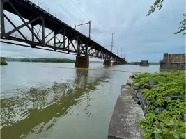
- Award-winning expertise in infrastructure projects, including powerline and bridge inspections.
Services
Land Surveying
Our land surveying services utilize state-of-the-art equipment to deliver precise measurements for infrastructure planning and development. We support projects ranging from route surveying to complex construction monitoring, ensuring compliance with regulatory standards. Our expertise enables clients to mitigate risks and optimize site layouts for efficient project execution.
Aerial Mapping
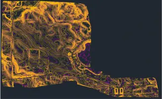
Using advanced LiDAR and drone technology, we capture high-density aerial data for detailed terrain and infrastructure analysis. This service accelerates project timelines while maintaining exceptional accuracy for applications like floodplain mapping and asset management. Clients benefit from faster decision-making and reduced fieldwork requirements.
GIS Consulting
Our GIS consulting services integrate geospatial data into strategic planning and asset management systems. We develop customized solutions for utilities, transportation networks, and environmental projects, enhancing operational efficiency through data-driven insights. Clients gain actionable intelligence to support sustainable infrastructure development.
Subsurface Utility Engineering
We employ ground-penetrating radar and electromagnetic detection to locate and map underground utilities with high precision. This service minimizes excavation risks and ensures compliance with safety regulations for construction and maintenance projects. Clients receive detailed subsurface data to prevent costly disruptions.
Powerline Inspection
Our powerline inspection services use aerial and ground-based technologies to assess transmission line integrity and vegetation encroachment. This proactive approach identifies potential failures, ensuring grid reliability and compliance with FAC-008 standards. Clients reduce downtime and maintenance costs through our detailed inspection reports.
Questions
What industries does SAM serve?
We support utilities, transportation, government, and natural resources sectors with geospatial data solutions.
How quickly can SAM deploy for a project?
Our teams deploy within 24 hours to initiate data collection for urgent projects.
What technologies does SAM use?
We utilize LiDAR, drones, GIS software, and 3D laser scanning for precise data capture.
Does SAM handle large-scale infrastructure projects?
Yes, we manage projects from local route surveying to multibillion-dollar infrastructure programs.
Is SAM recognized for workplace culture?
We've been named a Top Workplace by Charlotte Magazine and Long Island Press for our collaborative environment.
What accreditations does SAM hold?
We maintain Texas Firm Registration No. 10064300 and adhere to industry safety standards.
Reviews (2)
Robert H.
Jul 16, 2021
Report
Very fast and very professional. My land hadn't been surveyed in over 20 years, they started right off and found all the spikes for my land and my neighbors. Then I impromptu asked them to flag the entire line between our properties. They said yes sir, and went to town on them. Finished over 10 acres in about 5 hours.
Darlene Waite
Nov 21, 2020
Report
I hired Wellston Associates to locate my four corner pins on my property. Shawn got me in pretty quickly. He came out, found my corner pins and marked them exactly how I requested. He was courteous, professional, thorough and got the job done quickly. Their rates are reasonable as well. I would definitely recommend them and I couldn't be more pleased with my experience.