Business Details
50+ Years
experience
Your Trusted Partner for Surveying Solutions in Jacksonville, FL
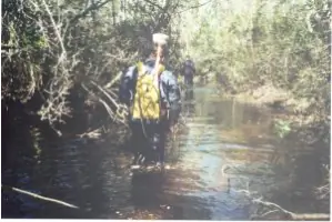
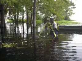
Degrove Surveyors has been a leader in land and hydrographic surveying since 1971, delivering precise geospatial data to public and private sector clients across the Southeastern United States. With offices in Jacksonville and Gainesville, Florida, our team of licensed professionals combines decades of experience with advanced technology to meet the most demanding project requirements. Our staff includes two licensed professional surveyors with nearly 70 years of combined expertise, two NSPS/THSOA Certified Hydrographers, and a dedicated technical team trained in specialized surveying techniques. We maintain rigorous quality control standards while utilizing cutting-edge equipment like robotic total stations, multibeam echosounders, and GPS systems to ensure accuracy in diverse environments. Our commitment to technical excellence is demonstrated through our work with federal agencies such as the U.S.Army Corps of Engineers and local entities like the Jacksonville Electric Authority. Degrove Surveyors' leadership team holds prestigious industry certifications and has received recognition including the JEA Blue Ribbon Award for Outstanding Performance. We invest in specialized vehicles and watercraft to access challenging terrains, from swamps to offshore locations, while maintaining a client-focused approach that emphasizes clear communication and timely delivery. Our 41-year track record includes 25 years of hydrographic surveying and 15 years of subsurface utility engineering experience. We serve engineering firms, government agencies, and private developers with services ranging from boundary surveys to expert witness testimony. Our dedication to professional development ensures our team remains at the forefront of surveying technology and methodology.
Services
Boundary Surveys
Hydrographic Surveying
Subsurface Utility Location
Topographic Surveys
Construction Stakeout
ALTA Surveys
GIS Mapping
Expert Witness Services
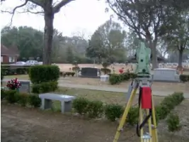
Cemetery Consulting
Tree Surveys
Details
- Year established: 1971
Highlights and features
- 41 years of continuous operation with 25 years of hydrographic expertise
- Only surveying firm to receive the JEA Blue Ribbon Award for Outstanding Performance
- NSPS/THSOA Certified Hydrographers with specialized offshore experience
- Equipped with advanced technology including multibeam echosounders and GPS systems
- Licensed to operate in seven Southeastern states including Florida and Georgia
Associations and certifications
- ACSM-THSOA Certified Hydrographer
- HYPACK and HYSWEEP Certified Hydrographer
- UTA Certified Professional Subsurface Utility Locator
Services
Boundary Surveys
Our boundary surveys establish precise property lines using advanced GPS technology and historical records. We deliver accurate legal descriptions for real estate transactions, development projects, and dispute resolution. Our licensed surveyors ensure compliance with state regulations while maintaining detailed documentation for future reference.
Hydrographic Surveying
Degrove's hydrographic surveys map underwater terrain using single-beam and multibeam echosounders. We support coastal engineering, dredging projects, and environmental assessments with bathymetric data. Our certified hydrographers conduct offshore surveys for oil platforms and underwater infrastructure inspections.
Subsurface Utility Location
We employ ground-penetrating radar and electromagnetic detection to identify underground utilities. Our TWIC-certified technicians perform non-destructive soft digs using hydro-vacuum excavation. This service prevents damage during construction projects while maintaining OSHA compliance for excavation safety.
Topographic Surveys
Our topographic surveys create detailed elevation models using robotic total stations and RTK GPS. We document natural and man-made features for site planning, drainage analysis, and construction design. Deliverables include digital terrain models compatible with CAD software for engineering applications.
Construction Stakeout
Degrove provides precise construction layout services using robotic total stations and 3D machine control systems. We ensure accurate placement of buildings, roads, and utilities according to engineering plans. Our team supports grading, paving, and structural steel erection with real-time positioning data.
People
Ray Niles
President
Licensed surveyor with 30+ years' experience and ACSM-THSOA certification. Leads Degrove's technical operations while maintaining client relationships with government agencies. Holds University of Florida degree and multiple industry awards.
Brenda Catone
Project Manager
Specializes in residential and industrial subdivisions with 40+ years' experience. Manages complex survey projects for public agencies and private developers. Holds Florida surveyor license and mathematics degree from University of North Florida.
Matt Niles
Project Manager
Hydrographic expert with offshore survey experience across three continents. Holds MS in Hydrographic Science and FIG/IHO certification. Oversees marine survey operations and equipment calibration for coastal projects.
Questions
What geographic areas do you serve?
Degrove Surveyors operates throughout the Southeastern United States, including Florida, Georgia, Alabama, Mississippi, Louisiana, and the Carolinas.
What surveying certifications do your staff hold?
Our team includes ACSM-THSOA Certified Hydrographers, HYPACK-certified professionals, and UTA-certified subsurface utility locators with specialized offshore and environmental expertise.
What equipment do you use for challenging projects?
We utilize robotic total stations, multibeam echosounders, GPS systems, and specialized vehicles including Marshmaster amphibious craft and survey boats for remote access.
How do you handle large-scale infrastructure projects?
Our experienced project managers coordinate multi-crew operations with quality control systems to ensure timely delivery for transportation, utility, and coastal engineering projects.
What industries do you primarily serve?
We support engineering firms, government agencies, and private developers with services for construction, environmental assessment, and land development projects.