Business Details
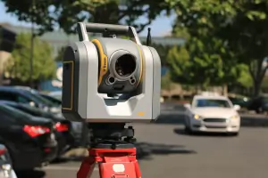
We are a professional land surveying firm based in Plant City, Florida, dedicated to delivering precise and reliable surveying services. With a commitment to excellence, we utilize advanced technologies such as GPS, 3D laser scanning, and aerial mapping to ensure accuracy in every project. Our team of licensed professionals has extensive experience in both residential and commercial surveying, prioritizing timely completion and competitive pricing. We specialize in boundary disputes, construction layouts, and elevation certifications, ensuring all work meets stringent legal and industry standards. Our obligation remains steadfast: to establish true property lines, verify them against official records, and certify results that withstand scrutiny from lenders, governments, and property owners.
We maintain transparency in all operations, providing clients with clear documentation and support. Our 22 specialized services cater to diverse needs, from flood risk assessments to subdivision platting, reflecting our comprehensive expertise. We pride ourselves on resolving complex land issues efficiently, minimizing future disputes and costs for clients. Our work serves as the foundational blueprint for development, construction, and property transactions. We continuously adapt to technological advancements while upholding traditional principles of accuracy and integrity. Client satisfaction remains our ultimate goal, achieved through personalized service and unwavering professionalism.
We maintain transparency in all operations, providing clients with clear documentation and support. Our 22 specialized services cater to diverse needs, from flood risk assessments to subdivision platting, reflecting our comprehensive expertise. We pride ourselves on resolving complex land issues efficiently, minimizing future disputes and costs for clients. Our work serves as the foundational blueprint for development, construction, and property transactions. We continuously adapt to technological advancements while upholding traditional principles of accuracy and integrity. Client satisfaction remains our ultimate goal, achieved through personalized service and unwavering professionalism.

Highlights and features
- We are licensed and certified by the State of Florida.
- We utilize advanced technologies like GPS and 3D laser scanning.
- We offer 22 specialized surveying services for diverse client needs.
- We guarantee accurate, certified results for legal and construction requirements.
- We prioritize client satisfaction with timely, transparent, and professional service.
Services
Boundary Survey
A Boundary Survey identifies property lines and recovers existing monuments. It is crucial for resolving disputes, purchasing property, or subdividing land. Our licensed surveyors use field data and official records to deliver certified results that protect ownership rights and comply with legal standards.
Topographic Survey
A Topographic Survey maps ground contours and features using precise elevation data. This service supports design and development projects by providing detailed site information. Clients receive accurate plans that facilitate engineering, construction, and environmental assessments.
Construction Survey
A Construction Survey establishes control points and verifies building alignment during development. It ensures structures are built according to approved plans. Our surveys support contractors and developers by minimizing errors and avoiding costly delays through precise stakeouts.
Elevation Certificate
An Elevation Certificate documents building heights for flood insurance purposes. It is required in high-risk areas to determine premiums. Our certified surveys provide the necessary data to comply with FEMA regulations and reduce insurance costs for property owners.
ALTA Land Title Survey
An ALTA Survey meets strict standards for commercial property transactions. It details boundaries, encumbrances, and improvements. This service is essential for lenders and attorneys to verify title insurance coverage and ensure clear property ownership.
Reviews (2)
Naz & Jess E.
Mar 15, 2021
Report
Need a survey of your property done *ASAP* for any type of REFI or buy then CROW and his people are the ones for YOU with very Speedy service.
Erain Boxtha
Jun 04, 2020
Report
Truly exceptional individuals who know their trade. Explained every aspect of the work performed in a simplified method that I could understand. Will be sure to contract again and again