Business Details
50 Years
experience
Your Trusted Land Surveying and GIS Solutions in Santa Rosa
Since 1976, Ray Carlson & Associates has been a trusted leader in land surveying and geographic information systems across California's North Bay region. Our firm combines decades of expertise with cutting-edge technology, including GPS equipment and drones, to deliver precise data management solutions for residential, commercial, and agricultural clients. With a deep understanding of local land records and regulations, we provide tailored services for vineyard development, property boundary analysis, and court-admissible mapping.Our team of certified professionals maintains strong relationships with regional agencies to ensure seamless project completion. We pioneered GIS integration in Sonoma County, offering layered data visualization for irrigation planning, yield optimization, and environmental compliance. Our commitment to innovation is matched by our dedication to community stewardship and client education, as demonstrated through custom 3D fly-through presentations and technical training programs.
Services
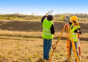
Land Surveys
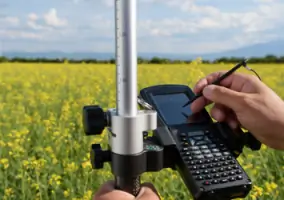
GIS Mapping
Vineyard Services
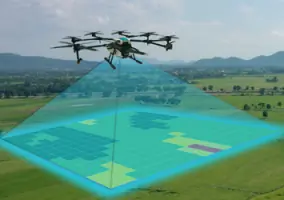
Aerial Photography
Court Exhibits Mapping
Details
- Year established: 1976
Highlights and features
- We have over 40 years of experience in North Bay land surveying
- Our team pioneered GPS surveying technology in Sonoma County
- We offer vineyard-specific GIS systems with vine-level precision
- Our staff includes certified GIS professionals with forestry expertise
- We provide court-admissible mapping solutions with historical records
Associations and certifications
- Professional Land Surveyor (P.L.S.)
- GIS Certification
What people say
Exceptional service
Highest quality work
Professional staff
Innovative technology
Thorough research
Services
Land Surveys
Professional boundary surveys using GPS and drone technology ensure precise property line determination. Our services include parcel mapping, easement identification, and subdivision planning for residential and commercial properties. We maintain historical records of over 5,000 land parcels for accurate retracement.
GIS Mapping
Custom geographic information systems track underground utilities, vineyard layouts, and environmental features. Our GIS solutions integrate with AutoCAD and ESRI platforms for layered analysis of soil types, topography, and agricultural planning requirements.
Vineyard Services
Specialized mapping for vineyard development includes irrigation layout, yield analysis, and appellation documentation. We provide as-built records and compliance reports for regulatory agencies, with precision down to individual vine locations.
Aerial Photography
UAV-based aerial surveys capture high-resolution imagery for property documentation. Our drone technology enables 3D modeling and fly-through presentations that combine mapping data with client branding elements for marketing purposes.
Court Exhibits Mapping
Forensic mapping services create admissible evidence for property disputes. We combine historical records, aerial photography, and field measurements to produce detailed exhibits for boundary conflicts and easement violations.
People
Ray C. Carlson
President
Founder with 40+ years of North Bay surveying experience, specializing in boundary retracement and vineyard development. Holds P.L.S. #3890 certification and maintains extensive knowledge of local land records and agency regulations.
Walter Moody
GIS Manager
Certified GIS professional with forestry background, managing spatial data systems since 1991. Specializes in agricultural applications of remote sensing technology and develops customized mapping solutions for land management and stewardship.
Questions
What surveying services do you offer?
We provide boundary surveys, parcel mapping, GPS data collection, and court-admissible mapping solutions for residential, commercial, and agricultural properties.
How can GIS benefit my vineyard?
Our vineyard-specific GIS systems track irrigation, yield data, and compliance requirements at vine-level precision to optimize production and regulatory reporting.
Do you work with real estate transactions?
Yes, we create parcel maps, record of surveys, and tentative maps for property subdivisions and boundary clarifications required during real estate transactions.
What technology do you use?
We employ GPS equipment, drones, 3D modeling software, and GIS systems for accurate data collection, analysis, and visualization of land features.
Are your surveyors licensed?
Yes, our team includes Professional Land Surveyors with state certifications and extensive experience in North Bay land records.
Reviews (3)
Joshua Rogers
Jun 23, 2022
Report
I can't speak highly enough of the Ray Carlson team. They were very responsive and able to schedule us in sooner than some people could even return my calls. They did a ton of research before surveying my property and advised me beforehand what the costs could be if they couldn't find necessary markers. Thankfully they were able to find everything needed. They were up front about everything and honest about the surveying process and price. I would hire them again without hesitation.
Barbara Rock
Jun 26, 2020
Report
Ray has helped us with consulting and survey issues for going on twenty years now. He is our number one choice because of the depth of his expertise, and because he always goes above and beyond on every job. Thank you, Ray!
Cindee Nelson
Nov 11, 2019
Report
Great company to work for. Ray is a very dedicated Land Surveyor. His integrity and honesty is refreshing in the business world. He provides great service to his clients.