Business Details
27 Years
experience
Professional Surveying Services in Brookville, PA
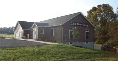
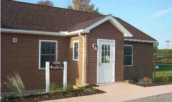
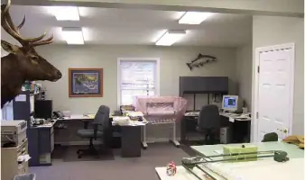
Since 1999, DEM Surveying has been dedicated to delivering high-quality professional surveying services to clients across Pennsylvania. Our firm, founded by Daniel E. Moore, PLS, relocated to a modern office in Brookville Industrial Park in 2006, enhancing our capacity to serve diverse projects. In 2009, we achieved HUBZone certification, underscoring our commitment to excellence and community engagement. Our team utilizes cutting-edge technology, including GPS systems and AutoCAD software, to ensure precision in boundary surveys, topographic mapping, and construction stake-out projects. We maintain rigorous safety standards, with personnel certified in EPA 40-hour hazardous training and compliance with DOT regulations for pipeline surveys. Professional liability insurance and comprehensive commercial coverage protect our clients and operations.Our office facilities, designed for efficiency and collaboration, support a skilled team with expertise in volumetric calculations, erosion control plans, and GIS mapping. With a fleet of equipped vehicles and specialized equipment like hydrographic boats and metal detectors, we tackle projects of all scales. Active memberships in professional organizations like the Pennsylvania Society of Land Surveyors and the National Society of Professional Surveyors keep us at the forefront of industry advancements. For over two decades, we have prioritized client satisfaction through accurate data, timely deliverables, and a deep understanding of Pennsylvania's geographic challenges.
Services
Boundary Surveys
ALTA-ACSM Surveys
Topographic Mapping
Construction Stake-Out
Volumetric Calculations
Pipeline Surveys
Erosion Control Plans
GPS Surveying
GIS Mapping
Hazardous Site Assessments
Details
- Year established: 1999
Highlights and features
- We have over 20 years of experience in Pennsylvania land surveying.
- Our team holds EPA 40-hour hazardous site certification for complex projects.
- We utilize GPS systems with sub-centimeter accuracy for precise measurements.
- Our HUBZone certification demonstrates commitment to community development.
- We carry professional liability insurance for client protection.
Associations and certifications
- HUBZone
Services
Boundary Surveys
Our boundary surveys precisely define property lines using advanced GPS and total station technology. We research historical records and locate physical markers to resolve disputes and support real estate transactions. Clients receive detailed maps compliant with Pennsylvania land title standards.
Construction Stake-Out
We provide accurate stake-out services for construction projects, ensuring structures align with design plans. Our team marks critical points for foundations, utilities, and infrastructure using robotic total stations. This service supports efficient grading and reduces costly rework during development.
Topographic Surveys
Our topographic surveys capture natural and man-made features with high-resolution GPS and LiDAR. We create detailed elevation models for engineering designs, environmental assessments, and land development. Deliverables include AutoCAD files and color plots for project visualization.
Pipeline Surveys
We conduct specialized surveys for gas and oil pipelines, including route planning and as-built documentation. Our team complies with DOT regulations and hazardous site protocols. Services include centerline mapping, depth verification, and GIS integration for pipeline management systems.
Erosion Control Plans
Our erosion and sedimentation control plans meet Pennsylvania DEP requirements for construction sites. We assess drainage patterns and design BMPs to minimize environmental impact. Plans include site-specific measures for slope stabilization and sediment containment.
People
Daniel E. Moore
Founder, Professional Land Surveyor
With over 20 years of experience, Daniel established DEM Surveying in 1999. He holds certifications in hazardous site safety and leads complex boundary resolution projects across Pennsylvania.
Steven T. Korchak
Surveyor
Steven manages field operations and data processing, specializing in GPS surveying and GIS mapping. He ensures compliance with state regulations for all topographic and construction projects.
Questions
What geographic areas do you serve?
We provide surveying services throughout Pennsylvania, with a focus on Jefferson County and surrounding regions within a 1.5-hour drive from Pittsburgh and Erie.
Are your personnel certified for hazardous site work?
Yes, key field staff hold EPA 40-hour hazardous training certification for work on Superfund sites and other contaminated properties.
What surveying technologies do you use?
We employ GPS systems with 0.5 cm accuracy, robotic total stations, and GIS mapping software to ensure precise data collection and analysis.
Do you offer digital deliverables?
Yes, we provide final plans in AutoCAD format on digital media, including color plots and GIS-compatible files for client convenience.
Are you HUBZone certified?
Yes, we received HUBZone certification in 2009, qualifying for federal contracting opportunities in historically underutilized business zones.
What insurance coverage do you maintain?
We carry professional liability insurance and comprehensive commercial coverage to protect clients and ensure project continuity.