
Business Details
41 Years
experience
Your Trusted Partner for Land Surveying and Engineering Solutions
Founded in 1985 by Nils W. Joyner and Timothy L. Keeny, Joyner Keeny has established itself as a trusted provider of land planning, surveying, and civil engineering services. Our team of 34 professionals, including 9 Licensed Land Surveyors and 2 Professional Engineers, delivers accurate and timely solutions for residential, commercial, and municipal projects. With over 40 years of combined experience, we specialize in boundary surveys, subsurface utility exploration, stormwater management, and environmental permitting. Our commitment to advanced technology ensures precise data collection through GPS, ground-penetrating radar, and aerial imaging. We serve clients across the Southeastern United States, including North Carolina, Virginia, Georgia, and Florida.Our mission prioritizes client satisfaction through cost-effective, comprehensible services that meet regulatory standards. We hold licenses in six states and maintain a reputation for integrity in land evaluation and development. Our staffs expertise spans feasibility studies, master planning, and construction management, addressing complex project needs. By integrating sustainable practices, we support long-term land use solutions. Joyner Keeny remains dedicated to public safety and property protection through rigorous professional standards.
Services
Land Planning
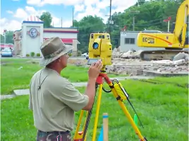
Boundary Surveys
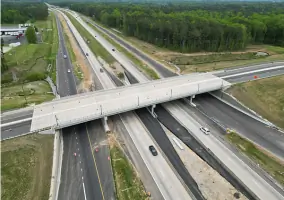
Civil Engineering
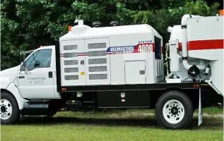
Subsurface Utility Exploration
Environmental Surveys
Stormwater Management
Details
- Year established: 1985
Highlights and features
- We have over 40 years of experience in land surveying and civil engineering.
- Our team includes 9 Licensed Land Surveyors and 2 Professional Engineers.
- We utilize advanced GPS and ground-penetrating radar technology for accuracy.
- We serve clients across six Southeastern states with tailored solutions.
- Our staff holds licenses in multiple disciplines for comprehensive project support.
Services
Land Planning
Our land planning services evaluate property potential through feasibility studies, yield analysis, and zoning compliance. We assist developers in maximizing land use for residential, commercial, or mixed-use projects. With 40+ years of expertise, we deliver master plans, entitlement strategies, and regulatory approvals tailored to client goals.
Boundary Surveys
We conduct precise boundary surveys using GPS and ALTA/ACSM standards to define property lines for legal and development purposes. Our team provides topographic data, easement identification, and recombination services. Clients receive detailed plats and legal descriptions to support transactions or construction projects.
Subsurface Utility Exploration
Our S.U.E. services map underground utilities using ground-penetrating radar and vacuum excavation. We identify water, gas, and electrical lines to prevent damage during construction. Quality Level A-D assessments ensure safety and compliance for infrastructure projects across municipal and private sectors.
Environmental Surveys
We perform environmental surveys for wetland delineation, brownfield mapping, and stormwater compliance. Our specialists evaluate land use impacts and develop erosion control plans. Services include permitting support and nutrient management strategies to meet federal and state regulations for sustainable development.
Stormwater Management
Our stormwater services design detention basins, flood mitigation systems, and drainage infrastructure. We conduct FEMA flood studies, elevation certifications, and CAMA permitting for coastal areas. With 20+ years of experience, we ensure compliance with environmental standards for municipal and military projects.
People
Nils W. Joyner
Member Manager
Nils W. Joyner co-founded Joyner Keeny in 1985 and oversees strategic operations. With a career spanning 40+ years, he specializes in land surveying and project management. He ensures adherence to licensing standards across six states.
Timothy L. Keeny
Co-Founder
Timothy L. Keeny co-founded Joyner Keeny in 1985. His expertise in civil engineering and surveying drives project execution. He mentors staff on advanced technologies and regulatory compliance for complex land development initiatives.
Karen Stone
Land Surveying Project Manager
Karen Stone leads surveying projects with 20+ years of experience. As a Licensed Land Surveyor and Professional Engineer, she specializes in boundary disputes, ALTA surveys, and team leadership for high-accuracy deliverables.
Nick Rightmyer
Engineering Project Manager
Nick Rightmyer manages civil engineering projects, focusing on stormwater systems and infrastructure design. His PE license supports technical oversight for municipal and commercial clients across the Southeastern United States.
Questions
What services does JoynerKeeny offer?
JoynerKeeny provides land planning, boundary surveys, civil engineering, subsurface utility exploration, environmental surveys, and stormwater management services for residential, commercial, and municipal clients.
How long has JoynerKeeny been in business?
JoynerKeeny has provided surveying and engineering services since 1985, with over 40 years of combined experience across its leadership team.
Which areas do you serve?
We serve clients in North Carolina, Virginia, Georgia, Florida, Kentucky, and Alabama, with offices in Rocky Mount and Fayetteville, NC.
What technologies do you use?
We utilize GPS, ground-penetrating radar, aerial imaging, and advanced CAD software to ensure precision in surveys and engineering projects.
Are your staff licensed professionals?
Yes, our team includes 9 Licensed Land Surveyors, 2 Professional Engineers, and 1 Engineering FE, ensuring compliance with state and federal standards.
Reviews (1)
Tonya Morris
Oct 25, 2019
Report
Joyner Keeny is an amazing place! There are very helpful and talented individuals that work there. They work hard for their customers and really know everything their is to know about surveying!