Business Details
Your Trusted Partner for Land Surveying Solutions in Ohio
Laurila Surveying has been delivering professional land surveying services across Ohio for decades. Our expertise spans boundary surveys, topographic mapping, subdivision plats, mortgage surveys, construction layout, and FEMA elevation certificates. We prioritize precision and client confidence by ensuring accurate property boundary establishment and documentation. Our team combines field and office operations to streamline data acquisition and deliver reliable results tailored to each project's unique requirements. With deep familiarity in Wayne, Medina, Summit, Stark, Ashland, and Holmes counties, we address complex surveying challenges while maintaining compliance with local regulations.Our commitment to quality ensures clients receive actionable insights to maximize their property investments. By integrating advanced technology with traditional methodologies, we minimize errors and rework, particularly in construction layout and topographic mapping. We transparently communicate cost factors influenced by terrain, monumentation, and historical survey data. Our services empower informed decision-making for residential, commercial, and infrastructure projects. Clients benefit from our dedication to clarity, ensuring they confidently navigate property transactions and development plans.
Services
Boundary Surveys
Subdivision Plats
Topographic Surveys
Construction Layout
FEMA Elevation Certificates
Highlights and features
- We offer decades of Ohio-specific surveying experience.
- Our team ensures precise boundary verification with permanent steel markers.
- We provide compliance-focused subdivision plats for government approvals.
- Our construction layout services minimize costly rework through accuracy.
- We utilize advanced technology for detailed topographic mapping.
Services
Boundary Surveys
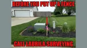
Our boundary surveys precisely establish deed dimensions on the ground, marking property corners with permanent steel markers. We document encroachments, fences, and monuments to ensure legal compliance. Clients receive verified boundary documentation for property transactions and development planning.
Subdivision Plats
We create subdivision plats that define lot areas, easements, and rights of way in compliance with zoning regulations. Our plats meet planning commission requirements for residential and commercial developments. Accurate mapping ensures smooth approval processes for property divisions.
Topographic Surveys
Our topographic surveys capture natural and man-made features, including elevations, utilities, and structures. Detailed contour maps support infrastructure planning and environmental assessments. Advanced equipment ensures precise data collection for construction and land development projects.
Construction Layout
We provide precise construction layout by marking building corners, column lines, and utility alignments. Our staking services ensure projects adhere to design plans and property boundaries. This minimizes errors and rework during development projects.
FEMA Elevation Certificates
We issue FEMA elevation certificates to determine flood insurance requirements for properties. Accurate elevation data helps clients secure appropriate coverage. Our certificates meet federal standards for floodplain management compliance.
Questions
What services does Laurila Surveying offer?
We provide boundary surveys, subdivision plats, topographic mapping, construction layout, and FEMA elevation certificates across Ohio counties.
How much does a land survey cost?
Basic surveys start at $1,800, with prices varying based on property complexity, monumentation, and required research.
Do you offer mortgage surveys?
Yes, we perform mortgage surveys to identify encroachments and boundary issues for property financing requirements.
What areas do you serve?
We operate in Wayne, Medina, Summit, Stark, Ashland, and Holmes counties in Ohio.
How long does a survey take?
Timelines vary by project scope, but we prioritize efficient data acquisition while maintaining accuracy for all survey types.