
Business Details
48 Years
experience
Your Trusted Land Surveying Partner in Southwestern Michigan
Mitchell & Morse Land Surveying has been a trusted name in land surveying since 1978. Our team of licensed professionals brings over four decades of experience to every project, combining advanced technology with time-tested expertise to deliver precise and reliable results. As a locally owned business now part of the Wightman family, we maintain a strong commitment to our community while expanding our capacity to serve clients across Southwestern Michigan. Our focus on accuracy, client collaboration, and innovation ensures that we meet the evolving needs of our customers. We specialize in boundary surveys, topographic mapping, and construction layout services, tailored to residential, commercial, and municipal projects.Our reputation for integrity and technical excellence has been built through consistent delivery of high-quality work. We prioritize clear communication and transparency, ensuring clients understand every step of the surveying process. Our deep familiarity with local regulations and terrain allows us to provide efficient, compliant solutions. By investing in cutting-edge equipment and continuous professional development, we maintain industry leadership while preserving the personal service that defines our approach. This combination of tradition and innovation positions us to handle projects of any scale with confidence and precision.

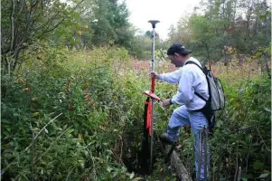
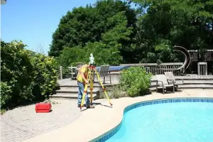
Services
Land Surveying
Boundary Surveys
Topographic Mapping
Construction Layout
Municipal Projects
Details
- Year established: 1978
Highlights and features
- We have over 45 years of experience in land surveying.
- Our team uses state-of-the-art technology for accurate results.
- We are locally owned and deeply rooted in the community.
- Our partnership with Wightman ensures comprehensive resources.
- We serve Berrien, Van Buren, and Allegan Counties with tailored solutions.
Services
Land Surveying
Our land surveying services provide precise measurements and legal documentation for property boundaries. Using advanced GPS and 3D scanning technology, we ensure accuracy for residential, commercial, and municipal projects. Clients benefit from our deep local knowledge and compliance with state regulations.
Topographic Mapping
We create detailed topographic maps showing natural and man-made features of the land. These maps are essential for construction planning, environmental assessments, and land development. Our digital deliverables integrate seamlessly with CAD and GIS systems for client convenience.
Questions
What services does Mitchell & Morse Land Surveying offer?
We specialize in boundary surveys, topographic mapping, construction layout, and ALTA/NSPS surveys for residential, commercial, and municipal clients.
How long has the company been in business?
We've served Southwestern Michigan since 1978, providing land surveying services for over 45 years.
What areas do you serve?
Our primary service areas include Berrien, Van Buren, and Allegan Counties in Michigan.
Are your surveyors licensed professionals?
Yes, all our surveyors are state-licensed professionals with extensive experience in land measurement and legal documentation.
Reviews (1)
DatsiKxModz
Mar 14, 2022
Report
They wanted 1500 for a 2 acre boundary markup for my property. Turns out they're also comedians. Store hours are wrong too the won't pick up after 4.