Business Details
38 Years
experience
Expert Land Surveying Services in Sparta, NJ
Founded in 1988, our firm has grown to become one of the leading surveying firms in the tri-state area. We specialize in construction, boundary, and topographic surveying across diverse disciplines, maintaining certifications and licenses for various applications across multiple states. Our veteran surveyors and highly skilled staff bring decades of experience to projects for state and federal agencies, utilities, municipalities, and private clients. We utilize state-of-the-art technology to ensure precision and efficiency, supported by a rigorous quality control network that delivers accuracy our clients can trust.Our expertise extends to complex subdisciplines including ALTA/ACSM surveys, photogrammetry, GPS surveys, and environmental monitoring. We pride ourselves on maintaining the highest professional standards while providing unparalleled project control from field to finish. Our team's deep local market knowledge in New York, New Jersey, and Pennsylvania enables us to address unique regional challenges effectively. We remain committed to advancing our industry through continuous training and adoption of cutting-edge surveying technologies.
Services
Construction Surveying
Boundary Surveying
Topographic Surveying
Aerial Survey
Photogrammetry
Details
- Year established: 1988
Highlights and features
- We offer 35+ years of specialized surveying expertise
- Our team maintains rigorous quality control standards
- We utilize state-of-the-art surveying technology
- We serve New York, New Jersey, and Pennsylvania markets
- Our staff includes veteran surveyors with deep regulatory knowledge
Services
Construction Surveying
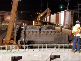
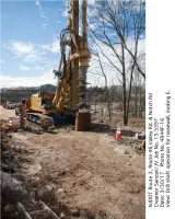
We provide precise layout and control surveys for construction projects, ensuring accurate implementation of engineering plans. Our services include machine control setup, high-order horizontal and vertical control, and as-built documentation. With expertise in volume surveys and deformation monitoring, we help prevent costly errors during all construction phases.
Boundary Surveying
Our boundary surveys combine legal expertise with technical precision to resolve property disputes and establish accurate land demarcations. We conduct ALTA/ACSM land title surveys, easement mapping, and right-of-way acquisitions using advanced total station and GPS technologies. Our work meets strict legal requirements for urban and rural properties.
Topographic Surveying
We create detailed topographic maps using aerial photogrammetry and hydrographic survey techniques. Our services include wetlands mapping, subsurface utility detection, and bathymetric surveys for engineering and environmental planning. Accurate elevation data supports drainage analysis, site development, and regulatory compliance efforts.
Aerial Survey
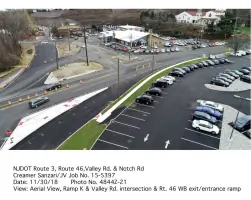
Our aerial survey services utilize advanced drone technology for high-resolution mapping and orthophoto generation. This technology supports efficient data collection for large areas, including route surveys, volume calculations, and environmental assessments. Results integrate seamlessly with traditional survey data for comprehensive site analysis.
Photogrammetry
We specialize in photogrammetric mapping for precise 3D modeling of land features and structures. Our services support engineering design, construction monitoring, and volumetric analysis. Using specialized software and calibrated equipment, we deliver accurate digital elevation models and orthorectified imagery for planning and documentation purposes.
Questions
What types of surveying services do you offer?
We provide construction, boundary, topographic, aerial, and photogrammetry surveying. Specialized services include ALTA/ACSM surveys, GPS surveys, and environmental monitoring projects.
What geographic areas do you serve?
Our primary service area includes New York, New Jersey, and Pennsylvania, with capabilities extending to specialized projects in adjacent regions.
Do you work with both public and private sector clients?
Yes, we partner with state and federal agencies, municipalities, utility companies, architects, engineering firms, and private landowners for diverse surveying needs.
What technology do you use in your surveys?
We employ advanced total station technology, real-time GPS systems, photogrammetry equipment, and digital aerial imagery programs for precise measurements.
Can you handle large-scale infrastructure projects?
Our experience includes complex projects like powerline upgrades, highway interchanges, airport infrastructure, and environmental remediation sites.