
Business Details
50+ Years
experience
Professional Land Surveying Services in Detroit Lakes, MN
Meadowland Surveying has been serving the lakes area since 1946, establishing itself as a trusted provider of professional land surveying services. Our family-owned business has completed over 15,000 surveys in Becker County and surrounding regions, working collaboratively with attorneys, architects, engineers, and government agencies to ensure project success. With a legacy of precision dating back to our founding, we maintain a commitment to accuracy and reliability in every survey we conduct. Our experienced team approaches each project with technical expertise and a dedication to client satisfaction, providing clear communication throughout the process. We specialize in boundary surveys, topographic mapping, construction staking, and property subdivisions, delivering solutions tailored to both residential and commercial needs.Our long-standing relationships with local professionals demonstrate our ability to meet industry standards while maintaining personalized service. By combining traditional surveying principles with modern technology, we continue to uphold the high standards set by our founders nearly eight decades ago. Clients benefit from our deep understanding of regional land features, including lakeshore boundaries and impervious surface requirements. Our track record of timely project completion and adherence to estimated costs has earned us recognition as the premier surveying company in the lakes area. This reputation, built through decades of consistent performance, reflects our ongoing dedication to excellence in land surveying services.
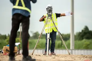
Services
ALTA/NSPS Surveys
Property Subdivision
Topographic Survey
Construction Staking
Impervious Surface Survey
Property Boundary Survey
Property Split
Details
- Year established: 1946
Highlights and features
- We have over 75 years of continuous service in Becker County
- Our team completes surveys with proven accuracy and reliability
- We maintain collaborative relationships with local professionals
- We provide clear communication throughout every project phase
- Our staff has completed over 15,000 local land surveys
What people say
Professional and accurate
Timely project completion
Clear communication
Knowledgeable field crew
Premier surveying company
Services
ALTA/NSPS Surveys
ALTA/NSPS Surveys provide comprehensive commercial property assessments meeting title insurance requirements. These detailed site surveys create scaled maps showing boundary lines, structures, easements, and other critical features for large-scale developments. Our certified professionals use advanced equipment to deliver accurate documentation that satisfies lenders and title companies for commercial property transactions.
Property Subdivision
Property Subdivision services create new lots or units for development through precise boundary determination. We handle residential, commercial, and storage developments including planned unit developments and common interest communities. Our process includes public hearing representation and preparation of legal descriptions to meet local zoning requirements while maintaining property value integrity.
Topographic Survey
Topographic Surveys map existing site conditions for construction or remodeling projects. These surveys identify boundary corners, structures, utilities, elevations, and water features like ordinary high water marks. Our detailed documentation meets permitting requirements while providing essential data for architectural and engineering design plans.
Construction Staking
Construction Staking services establish precise building locations and dimensions for new developments. We mark critical points for buildings, roads, and parking lots during both design and construction phases. Our accurate layout services ensure proper implementation of approved plans while minimizing costly field adjustments.
Property Boundary Survey
Property Boundary Surveys establish legal property lines through physical monumentation of corners and lines. We provide scaled maps showing boundary details, encroachments, and other relevant features. This service resolves property line disputes and supports accurate land transactions while meeting county recording requirements.
People
Scott R. Walz
President
Scott R. Walz oversees all survey projects with precision and reliability, continuing the company's tradition of excellence since acquiring the business in 2001. He maintains strong relationships with clients and local officials while ensuring technical accuracy in every survey conducted.
Roy A. Smith
Former Owner
Roy A. Smith built upon the company's reputation for accuracy from 1981-2001, known for his expertise in survey matters and ability to explain complex details clearly. His leadership maintained the business's standing as a trusted local surveying authority before passing the legacy to Scott Walz.
Carl J. Nedberg
Founder
Carl J. Nedberg established the company in 1946 with a commitment to accurate, dependable service that formed the foundation for seven decades of continuous operation. His pioneering work in Becker County surveying set standards that continue guiding the company's approach to client service.
Donald D. Busker
Former Owner
Donald D. Busker maintained surveying excellence during his ownership from 1969-1981, preserving the company's reputation for technical accuracy while expanding its capabilities to meet evolving industry standards in land development projects.
Tiffiny
Professional Staff
Tiffiny contributes to the company's success through client coordination and project management, maintaining the high service standards that have made Meadowland Surveying the premier choice in the lakes area for land surveying needs.
Questions
What types of land surveying services do you offer?
We provide ALTA/NSPS surveys, property subdivisions, topographic mapping, construction staking, impervious surface surveys, boundary surveys, and property splits for residential and commercial clients.
How long have you been serving the Detroit Lakes area?
Our company has provided surveying services in Becker County since 1946, maintaining continuous operation for over 75 years.
What makes your surveying company different from others?
Our combination of long-standing local expertise, proven track record of 15,000+ completed surveys, and personalized client communication distinguishes us from other surveying firms.
Do you work with government agencies and professionals?
Yes, we routinely collaborate with attorneys, architects, engineers, and local government agencies to ensure successful project completion.
How accurate are your land surveying services?
Our surveys maintain the highest accuracy standards through modern technology and experienced professionals, with consistent positive feedback from clients and partners.
Can you handle complex property division projects?
Yes, we specialize in property subdivisions and splits, including creating legal descriptions and representing projects at public hearings when required.
Reviews (1)
Marty Waller
Jul 10, 2019
Report
They arrived within the time frame given and called ahead as requested. Ryan and Ethan were very professional and answered all my questions making sure they addressed any concerns I had. I will use them for any future surveyor need.